Nong Wua So geodata
Nong Wua So (Changwat Udon Thani) is a seat of a second-order administrative division; located in Thailand in Asia/Bangkok (GMT+7) time zone. With population of 7,503 people, there are 299 cities with bigger population in this country. Compared to other cities in Thailand, 80.1% of cities are located further ↓South; 74.2% of cities are located further ←West and 87.5% of cities have lower elevation than Nong Wua So. Note1


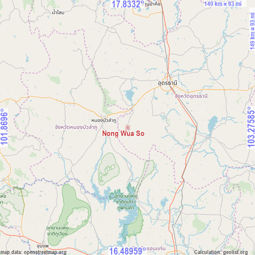
Nong Wua So GPS coordinates[2]
17° 9' 45.396" North, 102° 34' 21.792" East
| Map corner | latitude | longitude |
|---|---|---|
| Upper-left | 17.8332°, | 101.8696° |
| Center: | 17.16261°, | 102.57272° |
| Lower-right: | 16.48959°, | 103.27585° |
| Map W x H: | 149.4×149.4 km | = 92.8×92.8mi |
| max Lat: | 20.43353° ⇑19.9% North |
| Nong Wua So: | 17.16261° |
| min Lat: | ⇓80.1% South 5.77434° |
| min Long | Nong Wua So | max Long |
| 97.93288° | 102.57272° | 105.49506° |
| W 74.2%⇐ | ⇒25.8% E |
Elevation
Elevation of Nong Wua So is 239 m = 784 ft, and this is 113.5 m = 372 ft above average elevation for this country.
| Max E: |
1011 m = 3317 ft | 12.5% |
| Nong Wua So | 239 m 784 ft | |
| Avg. | 125.5 m = 412 ft | |
Min E: |
1 m = 3 ft | 87.5% |
See also: Thailand elevation on elevation.city.
Geographical zone
Nong Wua So is located in North Torrid zone (between Equator and Tropic of Cancer). Distance of this Northern Tropic circle is 697.6 km =433.5 mi to North.| Distance of | km | miles | from Nong Wua So |
|---|---|---|---|
| North Pole | 8098.8 | 5032.4 | to North |
| Arctic Circle | 5492.9 | 3413.1 | to North |
| Tropic Cancer | 697.6 | 433.5 | to North |
| Equator | 1908.3 | 1185.8 | to South |


Nearby cities:
15 places around Nong Wua So: (largest is in red/bold)
• Ban Na Muang
47.1 km =29.3 mi,  79°
79°
• Ban Phan Don
42.5 km =26.4 mi,  92°
92°
• Khuean Ubonrat
46 km =28.6 mi,  172°
172°
• Kumphawapi
47.4 km =29.5 mi,  97°
97°
• Kut Chap
29.3 km =18.2 mi,  358°
358°
• Na Klang
43.8 km =27.2 mi,  291°
291°
• Non Sa-at
39.8 km =24.7 mi,  120°
120°
• Non Sang
32.7 km =20.3 mi,  181°
181°
• Nong Bua Lamphu
14.8 km =9.2 mi, 288°
• Nong Na Kham
47.1 km =29.3 mi,  212°
212°
• Nong Saeng
22.1 km =13.7 mi, 88°
• Si Bun Rueang
38.3 km =23.8 mi,  235°
235°
• Suwanna Khuha
54.3 km =33.7 mi,  325°
325°
• Ubonratana
46 km =28.6 mi, 172°
• Udon Thani
36.1 km =22.4 mi,  38°
38°
Sources, notices
• [Note1] Compared only with cities in Thailand existing in our database
• [Src1] Map data: © OpenStreetMap contributors (CC-BY-SA)
• [Src2] Other city data from geonames.org with taken over terms of usage.
• [Src3] Geographical zone / Annual Mean Temperature by Robert A. Rohde @ Wikipedia
