Na Klang geodata
Na Klang (Changwat Nong Bua Lamphu) is a seat of a second-order administrative division; located in Thailand in Asia/Bangkok (GMT+7) time zone. With population of 31,024 people, there are 106 cities with bigger population in this country. Compared to other cities in Thailand, 82.1% of cities are located further ↓South; 69% of cities are located further ←West and 88.4% of cities have lower elevation than Na Klang. Note1


Na Klang GPS coordinates[2]
17° 18' 25.92" North, 102° 11' 19.896" East
| Map corner | latitude | longitude |
|---|---|---|
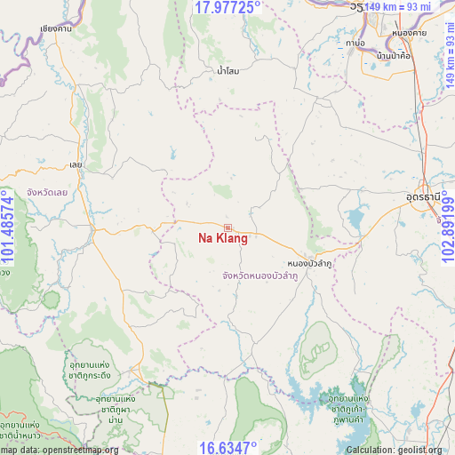
| Upper-left | 17.97725°, | 101.48574° |
| Center: | 17.3072°, | 102.18886° |
| Lower-right: | 16.6347°, | 102.89199° |
| Map W x H: | 149.3×149.3 km | = 92.8×92.8mi |
| max Lat: | 20.43353° ⇑17.9% North |
| Na Klang: | 17.3072° |
| min Lat: | ⇓82.1% South 5.77434° |
| min Long | Na Klang | max Long |
| 97.93288° | 102.18886° | 105.49506° |
| W 69%⇐ | ⇒31% E |
Elevation
Elevation of Na Klang is 253 m = 830 ft, and this is 127.5 m = 418 ft above average elevation for this country.
| Max E: |
1011 m = 3317 ft | 11.6% |
| Na Klang | 253 m 830 ft | |
| Avg. | 125.5 m = 412 ft | |
Min E: |
1 m = 3 ft | 88.4% |
See also: Thailand elevation on elevation.city.
Geographical zone
Na Klang is located in North Torrid zone (between Equator and Tropic of Cancer). Distance of this Northern Tropic circle is 681.5 km =423.5 mi to North.| Distance of | km | miles | from Na Klang |
|---|---|---|---|
| North Pole | 8082.7 | 5022.4 | to North |
| Arctic Circle | 5476.8 | 3403.1 | to North |
| Tropic Cancer | 681.5 | 423.5 | to North |
| Equator | 1924.4 | 1195.8 | to South |


Nearby cities:
15 places around Na Klang: (largest is in red/bold)
• Ban Phue
52.4 km =32.6 mi,  35°
35°
• Erawan
25 km =15.5 mi,  268°
268°
• Kut Chap
42.2 km =26.2 mi,  71°
71°
• Loei
53 km =32.9 mi,  292°
292°
• Na Wang
11.9 km =7.4 mi,  279°
279°
• Nam Som
51.5 km =32 mi,  0°
0°
• Nong Bua Lamphu
29.1 km =18.1 mi,  113°
113°
• Nong Hin
40.7 km =25.3 mi,  239°
239°
• Nong Wua So
43.8 km =27.2 mi, 111°
• Pha Khao
31.8 km =19.8 mi,  212°
212°
• Si Bun Rueang
38.9 km =24.2 mi,  166°
166°
• Si Chomphu
56.5 km =35.1 mi,  180°
180°
• Suwanna Khuha
30 km =18.6 mi,  18°
18°
• Suwannakhuha
30 km =18.6 mi, 18°
• Wang Saphung
44.6 km =27.7 mi, 269°
Sources, notices
• [Note1] Compared only with cities in Thailand existing in our database
• [Src1] Map data: © OpenStreetMap contributors (CC-BY-SA)
• [Src2] Other city data from geonames.org with taken over terms of usage.
• [Src3] Geographical zone / Annual Mean Temperature by Robert A. Rohde @ Wikipedia
