Nong Bua Lamphu geodata
Nong Bua Lamphu (Changwat Nong Bua Lamphu) is a seat of a first-order administrative division; located in Thailand in Asia/Bangkok (GMT+7) time zone. With population of 34,401 people, there are 98 cities with bigger population in this country. Compared to other cities in Thailand, 80.8% of cities are located further ↓South; 72.6% of cities are located further ←West and 84.9% of cities have lower elevation than Nong Bua Lamphu. Note1


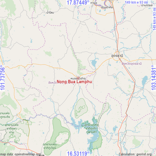
Nong Bua Lamphu GPS coordinates[2]
17° 12' 14.616" North, 102° 26' 26.448" East
| Map corner | latitude | longitude |
|---|---|---|
| Upper-left | 17.87449°, | 101.73756° |
| Center: | 17.20406°, | 102.44068° |
| Lower-right: | 16.53119°, | 103.14381° |
| Map W x H: | 149.4×149.4 km | = 92.8×92.8mi |
| max Lat: | 20.43353° ⇑19.2% North |
| Nong Bua Lamphu: | 17.20406° |
| min Lat: | ⇓80.8% South 5.77434° |
| min Long | Nong Bua Lamphu | max Long |
| 97.93288° | 102.44068° | 105.49506° |
| W 72.6%⇐ | ⇒27.4% E |
Elevation
Elevation of Nong Bua Lamphu is 217 m = 712 ft, and this is 91.5 m = 300 ft above average elevation for this country.
| Max E: |
1011 m = 3317 ft | 15.1% |
| Nong Bua Lamphu | 217 m 712 ft | |
| Avg. | 125.5 m = 412 ft | |
Min E: |
1 m = 3 ft | 84.9% |
See also: Thailand elevation on elevation.city.
Geographical zone
Nong Bua Lamphu is located in North Torrid zone (between Equator and Tropic of Cancer). Distance of this Northern Tropic circle is 693 km =430.6 mi to North.| Distance of | km | miles | from Nong Bua Lamphu |
|---|---|---|---|
| North Pole | 8094.1 | 5029.4 | to North |
| Arctic Circle | 5488.3 | 3410.3 | to North |
| Tropic Cancer | 693 | 430.6 | to North |
| Equator | 1912.9 | 1188.6 | to South |


Nearby cities:
15 places around Nong Bua Lamphu: (largest is in red/bold)
• Ban Phue
54 km =33.6 mi,  4°
4°
• Erawan
52.8 km =32.8 mi,  281°
281°
• Kut Chap
28.1 km =17.5 mi,  28°
28°
• Na Klang
29.1 km =18.1 mi,  293°
293°
• Na Wang
40.7 km =25.3 mi, 289°
• Non Sang
39.6 km =24.6 mi,  160°
160°
• Nong Na Kham
45.8 km =28.5 mi,  193°
193°
• Nong Saeng
36.4 km =22.6 mi,  96°
96°
• Nong Wua So
14.8 km =9.2 mi,  108°
108°
• Pha Khao
46.3 km =28.8 mi,  250°
250°
• Si Bun Rueang
31.6 km =19.6 mi,  213°
213°
• Si Chomphu
52.6 km =32.7 mi, 211°
• Suwanna Khuha
43.4 km =27 mi,  336°
336°
• Suwannakhuha
43.4 km =27 mi, 336°
• Udon Thani
43.5 km =27 mi,  57°
57°
Sources, notices
• [Note1] Compared only with cities in Thailand existing in our database
• [Src1] Map data: © OpenStreetMap contributors (CC-BY-SA)
• [Src2] Other city data from geonames.org with taken over terms of usage.
• [Src3] Geographical zone / Annual Mean Temperature by Robert A. Rohde @ Wikipedia
