Ban Na Muang geodata
Ban Na Muang (Changwat Udon Thani) is a seat of a second-order administrative division; located in Thailand in Asia/Bangkok (GMT+7) time zone. In our database, there are 331 cities with bigger population. Compared to other cities in Thailand, 81.1% of cities are located further ↓South; 78.7% of cities are located further ←West and 72.8% of cities have lower elevation than Ban Na Muang. Note1


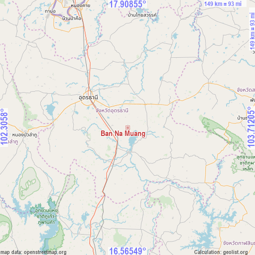
Ban Na Muang GPS coordinates[2]
17° 14' 17.664" North, 103° 0' 32.112" East
| Map corner | latitude | longitude |
|---|---|---|
| Upper-left | 17.90855°, | 102.3058° |
| Center: | 17.23824°, | 103.00892° |
| Lower-right: | 16.56549°, | 103.71205° |
| Map W x H: | 149.3×149.3 km | = 92.8×92.8mi |
| max Lat: | 20.43353° ⇑18.9% North |
| Ban Na Muang: | 17.23824° |
| min Lat: | ⇓81.1% South 5.77434° |
| min Long | Ban Na Muang | max Long |
| 97.93288° | 103.00892° | 105.49506° |
| W 78.7%⇐ | ⇒21.3% E |
Elevation
Elevation of Ban Na Muang is 177 m = 581 ft, and this is 51.5 m = 169 ft above average elevation for this country.
| Max E: |
1011 m = 3317 ft | 27.2% |
| Ban Na Muang | 177 m 581 ft | |
| Avg. | 125.5 m = 412 ft | |
Min E: |
1 m = 3 ft | 72.8% |
See also: Thailand elevation on elevation.city.
Geographical zone
Ban Na Muang is located in North Torrid zone (between Equator and Tropic of Cancer). Distance of this Northern Tropic circle is 689.2 km =428.2 mi to North.| Distance of | km | miles | from Ban Na Muang |
|---|---|---|---|
| North Pole | 8090.3 | 5027.1 | to North |
| Arctic Circle | 5484.5 | 3407.9 | to North |
| Tropic Cancer | 689.2 | 428.2 | to North |
| Equator | 1916.7 | 1191 | to South |


Nearby cities:
15 places around Ban Na Muang: (largest is in red/bold)
• Ban Nong Wua So
23.1 km =14.4 mi,  81°
81°
• Ban Phan Don
11.3 km =7 mi,  199°
199°
• Chaiwan
24.7 km =15.3 mi, 75°
• Ku Kaeo
17 km =10.6 mi,  115°
115°
• Kumphawapi
14.4 km =8.9 mi,  177°
177°
• Non Sa-at
31.3 km =19.4 mi, 203°
• Nong Han
17 km =10.6 mi,  36°
36°
• Nong Saeng
25.5 km =15.8 mi,  251°
251°
• Nong Wua So
47.1 km =29.3 mi,  259°
259°
• Phibun Rak
35.4 km =22 mi,  8°
8°
• Si That
36.8 km =22.9 mi,  143°
143°
• Song Dao
50.7 km =31.5 mi, 77°
• Tha Khantho
41.7 km =25.9 mi, 142°
• Thung Fon
37.2 km =23.1 mi,  45°
45°
• Udon Thani
30.8 km =19.1 mi,  309°
309°
Sources, notices
• [Note1] Compared only with cities in Thailand existing in our database
• [Src1] Map data: © OpenStreetMap contributors (CC-BY-SA)
• [Src2] Other city data from geonames.org with taken over terms of usage.
• [Src3] Geographical zone / Annual Mean Temperature by Robert A. Rohde @ Wikipedia
