Kut Chap geodata
Kut Chap (Changwat Udon Thani) is a seat of a second-order administrative division; located in Thailand in Asia/Bangkok (GMT+7) time zone. With population of 24,696 people, there are 129 cities with bigger population in this country. Compared to other cities in Thailand, 83.3% of cities are located further ↓South; 74.1% of cities are located further ←West and 80.1% of cities have lower elevation than Kut Chap. Note1


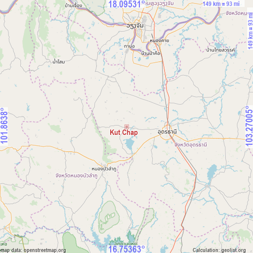
Kut Chap GPS coordinates[2]
17° 25' 32.52" North, 102° 34' 0.912" East
| Map corner | latitude | longitude |
|---|---|---|
| Upper-left | 18.09531°, | 101.8638° |
| Center: | 17.4257°, | 102.56692° |
| Lower-right: | 16.75363°, | 103.27005° |
| Map W x H: | 149.2×149.2 km | = 92.7×92.7mi |
| max Lat: | 20.43353° ⇑16.7% North |
| Kut Chap: | 17.4257° |
| min Lat: | ⇓83.3% South 5.77434° |
| min Long | Kut Chap | max Long |
| 97.93288° | 102.56692° | 105.49506° |
| W 74.1%⇐ | ⇒25.9% E |
Elevation
Elevation of Kut Chap is 197 m = 646 ft, and this is 71.5 m = 235 ft above average elevation for this country.
| Max E: |
1011 m = 3317 ft | 19.9% |
| Kut Chap | 197 m 646 ft | |
| Avg. | 125.5 m = 412 ft | |
Min E: |
1 m = 3 ft | 80.1% |
See also: Thailand elevation on elevation.city.
Geographical zone
Kut Chap is located in North Torrid zone (between Equator and Tropic of Cancer). Distance of this Northern Tropic circle is 668.4 km =415.3 mi to North.| Distance of | km | miles | from Kut Chap |
|---|---|---|---|
| North Pole | 8069.5 | 5014.2 | to North |
| Arctic Circle | 5463.6 | 3394.9 | to North |
| Tropic Cancer | 668.4 | 415.3 | to North |
| Equator | 1937.6 | 1204 | to South |


Nearby cities:
15 places around Kut Chap: (largest is in red/bold)
• Ban Na Muang
51.3 km =31.9 mi,  113°
113°
• Ban Phan Don
53.3 km =33.1 mi,  126°
126°
• Ban Phue
30.7 km =19.1 mi,  342°
342°
• Na Klang
42.2 km =26.2 mi,  251°
251°
• Na Wang
53.1 km =33 mi,  257°
257°
• Nong Bua Lamphu
28.1 km =17.5 mi,  208°
208°
• Nong Saeng
36.6 km =22.7 mi,  141°
141°
• Nong Wua So
29.3 km =18.2 mi,  178°
178°
• Phen
46.9 km =29.1 mi,  50°
50°
• Pho Tak
52.8 km =32.8 mi, 340°
• Sa Khrai
33.9 km =21.1 mi,  35°
35°
• Suwanna Khuha
34 km =21.1 mi,  296°
296°
• Suwannakhuha
34 km =21.1 mi, 296°
• Tha Bo
47.2 km =29.3 mi,  1°
1°
• Udon Thani
23.3 km =14.5 mi,  92°
92°
Sources, notices
• [Note1] Compared only with cities in Thailand existing in our database
• [Src1] Map data: © OpenStreetMap contributors (CC-BY-SA)
• [Src2] Other city data from geonames.org with taken over terms of usage.
• [Src3] Geographical zone / Annual Mean Temperature by Robert A. Rohde @ Wikipedia
