Nong Hi geodata
Nong Hi (Roi Et) is a seat of a second-order administrative division; located in Thailand in Asia/Bangkok (GMT+7) time zone. In our database, there are 331 cities with bigger population. Compared to other cities in Thailand, 59.9% of cities are located further ↓South; 90.3% of cities are located further ←West and 60.7% of cities have lower elevation than Nong Hi. Note1


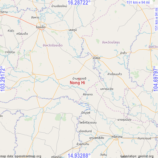
Nong Hi GPS coordinates[2]
15° 36' 40.212" North, 103° 59' 41.424" East
| Map corner | latitude | longitude |
|---|---|---|
| Upper-left | 16.28722°, | 103.29172° |
| Center: | 15.61117°, | 103.99484° |
| Lower-right: | 14.93288°, | 104.69797° |
| Map W x H: | 150.6×150.6 km | = 93.6×93.6mi |
| max Lat: | 20.43353° ⇑40.1% North |
| Nong Hi: | 15.61117° |
| min Lat: | ⇓59.9% South 5.77434° |
| min Long | Nong Hi | max Long |
| 97.93288° | 103.99484° | 105.49506° |
| W 90.3%⇐ | ⇒9.7% E |
Elevation
Elevation of Nong Hi is 149 m = 489 ft, and this is 23.5 m = 77 ft above average elevation for this country.
| Max E: |
1011 m = 3317 ft | 39.3% |
| Nong Hi | 149 m 489 ft | |
| Avg. | 125.5 m = 412 ft | |
Min E: |
1 m = 3 ft | 60.7% |
See also: Thailand elevation on elevation.city.
Geographical zone
Nong Hi is located in North Torrid zone (between Equator and Tropic of Cancer). Distance of this Northern Tropic circle is 870.1 km =540.7 mi to North.| Distance of | km | miles | from Nong Hi |
|---|---|---|---|
| North Pole | 8271.3 | 5139.5 | to North |
| Arctic Circle | 5665.4 | 3520.3 | to North |
| Tropic Cancer | 870.1 | 540.7 | to North |
| Equator | 1735.8 | 1078.6 | to South |


Nearby cities:
15 places around Nong Hi: (largest is in red/bold)
• At Samat
28.6 km =17.8 mi,  334°
334°
• Bueng Bun
31.7 km =19.7 mi,  170°
170°
• Kham Khuean Kaeo
33.9 km =21.1 mi,  82°
82°
• Maha Chana Chai
27.6 km =17.1 mi,  109°
109°
• Mueang Suang
36.9 km =22.9 mi,  309°
309°
• Non Narai
42.4 km =26.3 mi,  191°
191°
• Phanom Phrai
14.4 km =8.9 mi,  59°
59°
• Pho Si Suwan
43.4 km =27 mi, 168°
• Phon Sai
13.7 km =8.5 mi,  179°
179°
• Rasi Salai
34.2 km =21.3 mi,  149°
149°
• Rattanaburi
36.2 km =22.5 mi,  205°
205°
• Sai Mun
43.6 km =27.1 mi,  31°
31°
• Sila Lat
17.6 km =10.9 mi, 152°
• Suwannaphum
20.7 km =12.9 mi,  267°
267°
• Yasothon
25.9 km =16.1 mi,  38°
38°
Sources, notices
• [Note1] Compared only with cities in Thailand existing in our database
• [Src1] Map data: © OpenStreetMap contributors (CC-BY-SA)
• [Src2] Other city data from geonames.org with taken over terms of usage.
• [Src3] Geographical zone / Annual Mean Temperature by Robert A. Rohde @ Wikipedia
