Suwannaphum geodata
Suwannaphum (Roi Et) is a seat of a second-order administrative division; located in Thailand in Asia/Bangkok (GMT+7) time zone. With population of 12,221 people, there are 264 cities with bigger population in this country. Compared to other cities in Thailand, 59.7% of cities are located further ↓South; 88.3% of cities are located further ←West and 54.8% of cities have lower elevation than Suwannaphum. Note1


Suwannaphum GPS coordinates[2]
15° 36' 12.528" North, 103° 48' 7.452" East
| Map corner | latitude | longitude |
|---|---|---|
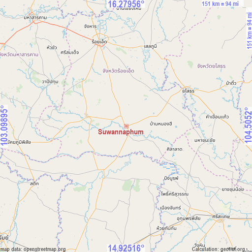
| Upper-left | 16.27956°, | 103.09895° |
| Center: | 15.60348°, | 103.80207° |
| Lower-right: | 14.92516°, | 104.5052° |
| Map W x H: | 150.6×150.6 km | = 93.6×93.6mi |
| max Lat: | 20.43353° ⇑40.3% North |
| Suwannaphum: | 15.60348° |
| min Lat: | ⇓59.7% South 5.77434° |
| min Long | Suwannaphum | max Long |
| 97.93288° | 103.80207° | 105.49506° |
| W 88.3%⇐ | ⇒11.7% E |
Elevation
Elevation of Suwannaphum is 136 m = 446 ft, and this is 10.5 m = 34 ft above average elevation for this country.
| Max E: |
1011 m = 3317 ft | 45.2% |
| Suwannaphum | 136 m 446 ft | |
| Avg. | 125.5 m = 412 ft | |
Min E: |
1 m = 3 ft | 54.8% |
See also: Thailand elevation on elevation.city.
Geographical zone
Suwannaphum is located in North Torrid zone (between Equator and Tropic of Cancer). Distance of this Northern Tropic circle is 871 km =541.2 mi to North.| Distance of | km | miles | from Suwannaphum |
|---|---|---|---|
| North Pole | 8272.1 | 5140 | to North |
| Arctic Circle | 5666.2 | 3520.8 | to North |
| Tropic Cancer | 871 | 541.2 | to North |
| Equator | 1734.9 | 1078 | to South |


Nearby cities:
15 places around Suwannaphum: (largest is in red/bold)
• At Samat
27.9 km =17.3 mi,  17°
17°
• Bueng Bun
40 km =24.9 mi,  139°
139°
• Chaturaphak Phiman
37.6 km =23.4 mi,  315°
315°
• Kaset Wisai
24.1 km =15 mi,  283°
283°
• Mueang Suang
25.5 km =15.8 mi,  342°
342°
• Non Narai
42.4 km =26.3 mi,  163°
163°
• Nong Hi
20.7 km =12.9 mi,  87°
87°
• Phanom Phrai
34 km =21.1 mi,  75°
75°
• Phon Sai
24.5 km =15.2 mi,  121°
121°
• Rattanaburi
32.1 km =19.9 mi,  171°
171°
• Sanom
44.7 km =27.8 mi,  185°
185°
• Sila Lat
32.4 km =20.1 mi, 116°
• Tha Tum
34.4 km =21.4 mi,  203°
203°
• Thung Khao Luang
43.9 km =27.3 mi,  8°
8°
• Yasothon
42.4 km =26.3 mi,  60°
60°
Sources, notices
• [Note1] Compared only with cities in Thailand existing in our database
• [Src1] Map data: © OpenStreetMap contributors (CC-BY-SA)
• [Src2] Other city data from geonames.org with taken over terms of usage.
• [Src3] Geographical zone / Annual Mean Temperature by Robert A. Rohde @ Wikipedia
