Thawat Buri geodata
Thawat Buri (Roi Et) is a seat of a second-order administrative division; located in Thailand in Asia/Bangkok (GMT+7) time zone. In our database, there are 331 cities with bigger population. Compared to other cities in Thailand, 66% of cities are located further ↓South; 87.2% of cities are located further ←West and 59.1% of cities have lower elevation than Thawat Buri. Note1


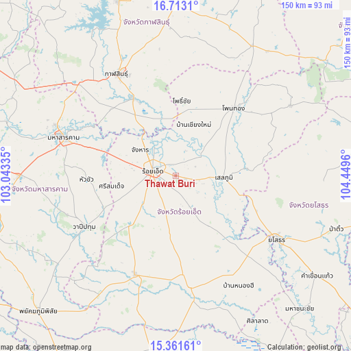
Thawat Buri GPS coordinates[2]
16° 2' 18.6" North, 103° 44' 47.292" East
| Map corner | latitude | longitude |
|---|---|---|
| Upper-left | 16.7131°, | 103.04335° |
| Center: | 16.0385°, | 103.74647° |
| Lower-right: | 15.36161°, | 104.4496° |
| Map W x H: | 150.3×150.3 km | = 93.4×93.4mi |
| max Lat: | 20.43353° ⇑34% North |
| Thawat Buri: | 16.0385° |
| min Lat: | ⇓66% South 5.77434° |
| min Long | Thawat Buri | max Long |
| 97.93288° | 103.74647° | 105.49506° |
| W 87.2%⇐ | ⇒12.8% E |
Elevation
Elevation of Thawat Buri is 146 m = 479 ft, and this is 20.5 m = 67 ft above average elevation for this country.
| Max E: |
1011 m = 3317 ft | 40.9% |
| Thawat Buri | 146 m 479 ft | |
| Avg. | 125.5 m = 412 ft | |
Min E: |
1 m = 3 ft | 59.1% |
See also: Thailand elevation on elevation.city.
Geographical zone
Thawat Buri is located in North Torrid zone (between Equator and Tropic of Cancer). Distance of this Northern Tropic circle is 822.6 km =511.1 mi to North.| Distance of | km | miles | from Thawat Buri |
|---|---|---|---|
| North Pole | 8223.7 | 5110 | to North |
| Arctic Circle | 5617.9 | 3490.8 | to North |
| Tropic Cancer | 822.6 | 511.1 | to North |
| Equator | 1783.3 | 1108.1 | to South |


Nearby cities:
15 places around Thawat Buri: (largest is in red/bold)
• At Samat
25.9 km =16.1 mi,  147°
147°
• Ban Selaphum
21.9 km =13.6 mi,  96°
96°
• Changhan
18.9 km =11.7 mi,  306°
306°
• Chaturaphak Phiman
29.5 km =18.3 mi,  223°
223°
• Chiang Khwan
13.9 km =8.6 mi,  3°
3°
• Kae Dam
38.7 km =24 mi,  267°
267°
• Kamalasai
38 km =23.6 mi,  331°
331°
• Mueang Suang
24.2 km =15 mi,  184°
184°
• Pho Chai
32.3 km =20.1 mi, 4°
• Roi Et
10.2 km =6.3 mi,  281°
281°
• Rong Kham
25.7 km =16 mi, 0°
• Selaphum
20.5 km =12.7 mi,  92°
92°
• Si Somdet
28 km =17.4 mi,  260°
260°
• Thung Khao Luang
13.4 km =8.3 mi,  111°
111°
• Waeng
38.2 km =23.7 mi,  40°
40°
Sources, notices
• [Note1] Compared only with cities in Thailand existing in our database
• [Src1] Map data: © OpenStreetMap contributors (CC-BY-SA)
• [Src2] Other city data from geonames.org with taken over terms of usage.
• [Src3] Geographical zone / Annual Mean Temperature by Robert A. Rohde @ Wikipedia
