Thung Khao Luang geodata
Thung Khao Luang (Roi Et) is a seat of a second-order administrative division; located in Thailand in Asia/Bangkok (GMT+7) time zone. In our database, there are 331 cities with bigger population. Compared to other cities in Thailand, 65.1% of cities are located further ↓South; 88.8% of cities are located further ←West and 53.3% of cities have lower elevation than Thung Khao Luang. Note1


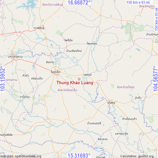
Thung Khao Luang GPS coordinates[2]
15° 59' 38.292" North, 103° 51' 45.504" East
| Map corner | latitude | longitude |
|---|---|---|
| Upper-left | 16.66872°, | 103.15952° |
| Center: | 15.99397°, | 103.86264° |
| Lower-right: | 15.31693°, | 104.56577° |
| Map W x H: | 150.3×150.3 km | = 93.4×93.4mi |
| max Lat: | 20.43353° ⇑34.9% North |
| Thung Khao Luang: | 15.99397° |
| min Lat: | ⇓65.1% South 5.77434° |
| min Long | Thung Khao Luan | max Long |
| 97.93288° | 103.86264° | 105.49506° |
| W 88.8%⇐ | ⇒11.2% E |
Elevation
Elevation of Thung Khao Luang is 131 m = 430 ft, and this is 5.5 m = 18 ft above average elevation for this country.
| Max E: |
1011 m = 3317 ft | 46.7% |
| Thung Khao Luang | 131 m 430 ft | |
| Avg. | 125.5 m = 412 ft | |
Min E: |
1 m = 3 ft | 53.3% |
See also: Thailand elevation on elevation.city.
Geographical zone
Thung Khao Luang is located in North Torrid zone (between Equator and Tropic of Cancer). Distance of this Northern Tropic circle is 827.6 km =514.2 mi to North.| Distance of | km | miles | from Thung Khao Luang |
|---|---|---|---|
| North Pole | 8228.7 | 5113.1 | to North |
| Arctic Circle | 5622.8 | 3493.8 | to North |
| Tropic Cancer | 827.6 | 514.2 | to North |
| Equator | 1778.4 | 1105 | to South |


Nearby cities:
15 places around Thung Khao Luang: (largest is in red/bold)
• At Samat
16.9 km =10.5 mi,  174°
174°
• Ban Selaphum
9.7 km =6 mi,  74°
74°
• Changhan
32 km =19.9 mi,  300°
300°
• Chaturaphak Phiman
36.6 km =22.7 mi,  243°
243°
• Chiang Khwan
22.1 km =13.7 mi,  328°
328°
• Mueang Suang
23.9 km =14.9 mi,  216°
216°
• Pho Chai
38.5 km =23.9 mi,  345°
345°
• Roi Et
23.5 km =14.6 mi,  287°
287°
• Rong Kham
33 km =20.5 mi,  338°
338°
• Sai Mun
37.3 km =23.2 mi,  98°
98°
• Selaphum
9 km =5.6 mi,  63°
63°
• Si Somdet
40.1 km =24.9 mi,  270°
270°
• Thawat Buri
13.4 km =8.3 mi, 291°
• Waeng
36.2 km =22.5 mi,  19°
19°
• Yasothon
37.5 km =23.3 mi,  126°
126°
Sources, notices
• [Note1] Compared only with cities in Thailand existing in our database
• [Src1] Map data: © OpenStreetMap contributors (CC-BY-SA)
• [Src2] Other city data from geonames.org with taken over terms of usage.
• [Src3] Geographical zone / Annual Mean Temperature by Robert A. Rohde @ Wikipedia
