Pho Chai geodata
Pho Chai (Roi Et) is a seat of a second-order administrative division; located in Thailand in Asia/Bangkok (GMT+7) time zone. With population of 13,671 people, there are 239 cities with bigger population in this country. Compared to other cities in Thailand, 69.9% of cities are located further ↓South; 88% of cities are located further ←West and 66.2% of cities have lower elevation than Pho Chai. Note1


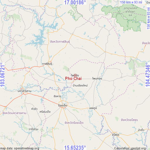
Pho Chai GPS coordinates[2]
16° 19' 41.772" North, 103° 46' 13.188" East
| Map corner | latitude | longitude |
|---|---|---|
| Upper-left | 17.00186°, | 103.06721° |
| Center: | 16.32827°, | 103.77033° |
| Lower-right: | 15.65235°, | 104.47346° |
| Map W x H: | 150.1×150.1 km | = 93.3×93.3mi |
| max Lat: | 20.43353° ⇑30.1% North |
| Pho Chai: | 16.32827° |
| min Lat: | ⇓69.9% South 5.77434° |
| min Long | Pho Chai | max Long |
| 97.93288° | 103.77033° | 105.49506° |
| W 88%⇐ | ⇒12% E |
Elevation
Elevation of Pho Chai is 162 m = 531 ft, and this is 36.5 m = 120 ft above average elevation for this country.
| Max E: |
1011 m = 3317 ft | 33.8% |
| Pho Chai | 162 m 531 ft | |
| Avg. | 125.5 m = 412 ft | |
Min E: |
1 m = 3 ft | 66.2% |
See also: Thailand elevation on elevation.city.
Geographical zone
Pho Chai is located in North Torrid zone (between Equator and Tropic of Cancer). Distance of this Northern Tropic circle is 790.4 km =491.1 mi to North.| Distance of | km | miles | from Pho Chai |
|---|---|---|---|
| North Pole | 8191.5 | 5090 | to North |
| Arctic Circle | 5585.6 | 3470.7 | to North |
| Tropic Cancer | 790.4 | 491.1 | to North |
| Equator | 1815.5 | 1128.1 | to South |


Nearby cities:
15 places around Pho Chai: (largest is in red/bold)
• Changhan
27.6 km =17.1 mi,  220°
220°
• Chiang Khwan
18.4 km =11.4 mi,  185°
185°
• Don Chan
16.4 km =10.2 mi,  330°
330°
• Huai Phueng
38.8 km =24.1 mi,  22°
22°
• Kalasin
30.4 km =18.9 mi,  292°
292°
• Kamalasai
20.8 km =12.9 mi,  273°
273°
• Khong Chai
34.2 km =21.3 mi,  257°
257°
• Kuchinarai
38.1 km =23.7 mi,  51°
51°
• Na Mon
27.7 km =17.2 mi,  3°
3°
• Roi Et
32.7 km =20.3 mi,  202°
202°
• Rong Kham
7 km =4.3 mi, 200°
• Selaphum
37.7 km =23.4 mi,  151°
151°
• Thawat Buri
32.3 km =20.1 mi,  184°
184°
• Thung Khao Luang
38.5 km =23.9 mi,  165°
165°
• Waeng
22.4 km =13.9 mi,  98°
98°
Sources, notices
• [Note1] Compared only with cities in Thailand existing in our database
• [Src1] Map data: © OpenStreetMap contributors (CC-BY-SA)
• [Src2] Other city data from geonames.org with taken over terms of usage.
• [Src3] Geographical zone / Annual Mean Temperature by Robert A. Rohde @ Wikipedia
