Ban Selaphum geodata
Ban Selaphum (Roi Et) is a populated place; located in Thailand in Asia/Bangkok (GMT+7) time zone. With population of 17,412 people, there are 182 cities with bigger population in this country. Compared to other cities in Thailand, 65.4% of cities are located further ↓South; 89.7% of cities are located further ←West and 53.9% of cities have lower elevation than Ban Selaphum. Note1


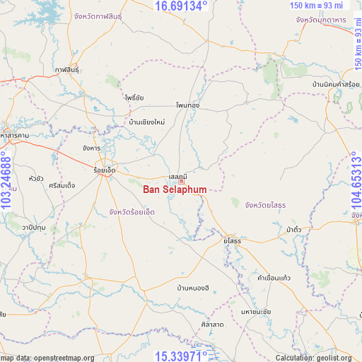
Ban Selaphum GPS coordinates[2]
16° 1' 0.012" North, 103° 57' 0" East
| Map corner | latitude | longitude |
|---|---|---|
| Upper-left | 16.69134°, | 103.24688° |
| Center: | 16.01667°, | 103.95° |
| Lower-right: | 15.33971°, | 104.65313° |
| Map W x H: | 150.3×150.3 km | = 93.4×93.4mi |
| max Lat: | 20.43353° ⇑34.6% North |
| Ban Selaphum: | 16.01667° |
| min Lat: | ⇓65.4% South 5.77434° |
| min Long | Ban Selaphum | max Long |
| 97.93288° | 103.95° | 105.49506° |
| W 89.7%⇐ | ⇒10.3% E |
Elevation
Elevation of Ban Selaphum is 133 m = 436 ft, and this is 7.5 m = 25 ft above average elevation for this country.
| Max E: |
1011 m = 3317 ft | 46.1% |
| Ban Selaphum | 133 m 436 ft | |
| Avg. | 125.5 m = 412 ft | |
Min E: |
1 m = 3 ft | 53.9% |
See also: Thailand elevation on elevation.city.
Geographical zone
Ban Selaphum is located in North Torrid zone (between Equator and Tropic of Cancer). Distance of this Northern Tropic circle is 825 km =512.6 mi to North.| Distance of | km | miles | from Ban Selaphum |
|---|---|---|---|
| North Pole | 8226.2 | 5111.5 | to North |
| Arctic Circle | 5620.3 | 3492.3 | to North |
| Tropic Cancer | 825 | 512.6 | to North |
| Equator | 1780.9 | 1106.6 | to South |


Nearby cities:
15 places around Ban Selaphum: (largest is in red/bold)
• At Samat
20.8 km =12.9 mi,  201°
201°
• Changhan
39.4 km =24.5 mi,  290°
290°
• Chiang Khwan
26.6 km =16.5 mi,  307°
307°
• Kut Chum
41.6 km =25.8 mi,  87°
87°
• Mueang Suang
32.1 km =19.9 mi,  227°
227°
• Phanom Phrai
41.4 km =25.7 mi,  155°
155°
• Pho Chai
39.6 km =24.6 mi,  331°
331°
• Roi Et
32 km =19.9 mi,  277°
277°
• Rong Kham
35.5 km =22.1 mi,  322°
322°
• Sai Mun
28.7 km =17.8 mi,  106°
106°
• Selaphum
1.9 km =1.2 mi, 319°
• Thawat Buri
21.9 km =13.6 mi, 276°
• Thung Khao Luang
9.7 km =6 mi,  254°
254°
• Waeng
31.7 km =19.7 mi,  5°
5°
• Yasothon
32.4 km =20.1 mi,  139°
139°
Sources, notices
• [Note1] Compared only with cities in Thailand existing in our database
• [Src1] Map data: © OpenStreetMap contributors (CC-BY-SA)
• [Src2] Other city data from geonames.org with taken over terms of usage.
• [Src3] Geographical zone / Annual Mean Temperature by Robert A. Rohde @ Wikipedia
