Tha Ruea geodata
Tha Ruea (Phra Nakhon Si Ayutthaya) is a seat of a second-order administrative division; located in Thailand in Asia/Bangkok (GMT+7) time zone. With population of 19,116 people, there are 165 cities with bigger population in this country. Compared to other cities in Thailand, 58.6% of cities are located further ↑North; 51% of cities are located further →East and 78.4% of cities have higher elevation than Tha Ruea. Note1


Tha Ruea GPS coordinates[2]
14° 34' 2.604" North, 100° 43' 33.528" East
| Map corner | latitude | longitude |
|---|---|---|
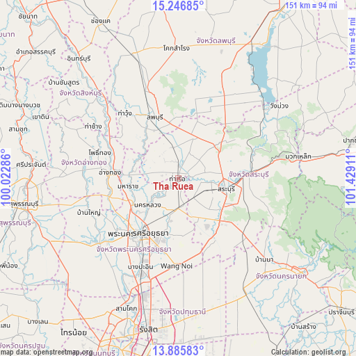
| Upper-left | 15.24685°, | 100.02286° |
| Center: | 14.56739°, | 100.72598° |
| Lower-right: | 13.88583°, | 101.42911° |
| Map W x H: | 151.3×151.3 km | = 94×94mi |
| max Lat: | 20.43353° ⇑58.6% North |
| Tha Ruea: | 14.56739° |
| min Lat: | ⇓41.4% South 5.77434° |
| min Long | Tha Ruea | max Long |
| 97.93288° | 100.72598° | 105.49506° |
| W 49%⇐ | ⇒51% E |
Elevation
Elevation of Tha Ruea is 13 m = 43 ft, and this is 112.5 m = 369 ft below average elevation for this country.
| Max E: |
1011 m = 3317 ft | 78.4% |
| Avg. | 125.5 m = 412 ft | |
| Tha Ruea | 13 m = 43 ft | |
Min E: |
1 m = 3 ft | 21.6% |
See also: Thailand elevation on elevation.city.
Geographical zone
Tha Ruea is located in North Torrid zone (between Equator and Tropic of Cancer). Distance of this Northern Tropic circle is 986.2 km =612.8 mi to North.| Distance of | km | miles | from Tha Ruea |
|---|---|---|---|
| North Pole | 8387.3 | 5211.6 | to North |
| Arctic Circle | 5781.4 | 3592.4 | to North |
| Tropic Cancer | 986.2 | 612.8 | to North |
| Equator | 1619.7 | 1006.4 | to South |


Nearby cities:
15 places around Tha Ruea: (largest is in red/bold)
• Ban Mo
5.3 km =3.3 mi,  1°
1°
• Ban Phraek
18.4 km =11.4 mi,  298°
298°
• Ban Thai Tan
26.4 km =16.4 mi,  283°
283°
• Bang Pahan
22.7 km =14.1 mi,  239°
239°
• Chaloem Phra Kiat
20.2 km =12.6 mi,  75°
75°
• Don Phut
10.9 km =6.8 mi, 284°
• Maha Rat
21.8 km =13.5 mi,  260°
260°
• Nakhon Luang
17.2 km =10.7 mi,  227°
227°
• Nong Don
13.2 km =8.2 mi,  352°
352°
• Nong Saeng
10.5 km =6.5 mi,  143°
143°
• Phachi
13.2 km =8.2 mi,  178°
178°
• Phra Phutthabat
19.1 km =11.9 mi,  23°
23°
• Sao Hai
12.9 km =8 mi,  98°
98°
• Saraburi
20.9 km =13 mi, 100°
• Uthai
23.5 km =14.6 mi,  194°
194°
Sources, notices
• [Note1] Compared only with cities in Thailand existing in our database
• [Src1] Map data: © OpenStreetMap contributors (CC-BY-SA)
• [Src2] Other city data from geonames.org with taken over terms of usage.
• [Src3] Geographical zone / Annual Mean Temperature by Robert A. Rohde @ Wikipedia
