Sam Phran geodata
Sam Phran (Nakhon Pathom) is a seat of a second-order administrative division; located in Thailand in Asia/Bangkok (GMT+7) time zone. With population of 37,115 people, there are 84 cities with bigger population in this country. Compared to other cities in Thailand, 70.8% of cities are located further ↑North; 66.2% of cities are located further →East and 94.4% of cities have higher elevation than Sam Phran. Note1


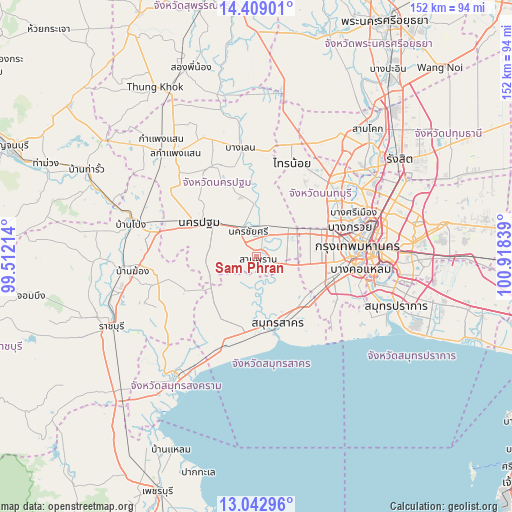
Sam Phran GPS coordinates[2]
13° 43' 37.128" North, 100° 12' 54.936" East
| Map corner | latitude | longitude |
|---|---|---|
| Upper-left | 14.40901°, | 99.51214° |
| Center: | 13.72698°, | 100.21526° |
| Lower-right: | 13.04296°, | 100.91839° |
| Map W x H: | 151.9×151.9 km | = 94.4×94.4mi |
| max Lat: | 20.43353° ⇑70.8% North |
| Sam Phran: | 13.72698° |
| min Lat: | ⇓29.2% South 5.77434° |
| min Long | Sam Phran | max Long |
| 97.93288° | 100.21526° | 105.49506° |
| W 33.8%⇐ | ⇒66.2% E |
Elevation
Elevation of Sam Phran is 7 m = 23 ft, and this is 118.5 m = 389 ft below average elevation for this country.
| Max E: |
1011 m = 3317 ft | 94.4% |
| Avg. | 125.5 m = 412 ft | |
| Sam Phran | 7 m = 23 ft | |
Min E: |
1 m = 3 ft | 5.6% |
See also: Thailand elevation on elevation.city.
Geographical zone
Sam Phran is located in North Torrid zone (between Equator and Tropic of Cancer). Distance of this Northern Tropic circle is 1079.6 km =670.8 mi to North.| Distance of | km | miles | from Sam Phran |
|---|---|---|---|
| North Pole | 8480.8 | 5269.7 | to North |
| Arctic Circle | 5874.9 | 3650.5 | to North |
| Tropic Cancer | 1079.6 | 670.8 | to North |
| Equator | 1526.3 | 948.4 | to South |


Nearby cities:
15 places around Sam Phran: (largest is in red/bold)
• Ban Phaeo
19.1 km =11.9 mi,  217°
217°
• Bang Bon
20.8 km =12.9 mi,  110°
110°
• Bang Khae
21.1 km =13.1 mi,  100°
100°
• Bang Khun Thian
24.7 km =15.3 mi, 106°
• Bang Yai
20.5 km =12.7 mi,  50°
50°
• Bangkok Yai
28.2 km =17.5 mi,  90°
90°
• Krathum Baen
9.5 km =5.9 mi,  149°
149°
• Nakhon Chai Si
8.9 km =5.5 mi,  338°
338°
• Nakhon Pathom
21.1 km =13.1 mi,  299°
299°
• Nong Khaem
14.7 km =9.1 mi, 99°
• Phasi Charoen
24 km =14.9 mi, 93°
• Salaya
14.2 km =8.8 mi, 53°
• Samut Sakhon
20.9 km =13 mi,  162°
162°
• Taling Chan
26.7 km =16.6 mi,  77°
77°
• Thawi Watthana
14.5 km =9 mi,  61°
61°
Sources, notices
• [Note1] Compared only with cities in Thailand existing in our database
• [Src1] Map data: © OpenStreetMap contributors (CC-BY-SA)
• [Src2] Other city data from geonames.org with taken over terms of usage.
• [Src3] Geographical zone / Annual Mean Temperature by Robert A. Rohde @ Wikipedia
