Nakhon Pathom geodata
Nakhon Pathom is a seat of a first-order administrative division; located in Thailand in Asia/Bangkok (GMT+7) time zone. With population of 117,927 people, there are 17 cities with bigger population in this country. Compared to other cities in Thailand, 67.3% of cities are located further ↑North; 71.1% of cities are located further →East and 83.5% of cities have higher elevation than Nakhon Pathom. Note1


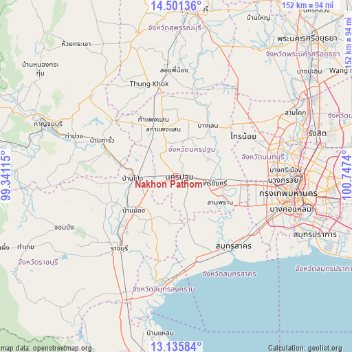
Nakhon Pathom GPS coordinates[2]
13° 49' 10.56" North, 100° 2' 39.372" East
| Map corner | latitude | longitude |
|---|---|---|
| Upper-left | 14.50136°, | 99.34115° |
| Center: | 13.8196°, | 100.04427° |
| Lower-right: | 13.13584°, | 100.7474° |
| Map W x H: | 151.8×151.8 km | = 94.3×94.3mi |
| max Lat: | 20.43353° ⇑67.3% North |
| Nakhon Pathom: | 13.8196° |
| min Lat: | ⇓32.7% South 5.77434° |
| min Long | Nakhon Pathom | max Long |
| 97.93288° | 100.04427° | 105.49506° |
| W 28.9%⇐ | ⇒71.1% E |
Elevation
Elevation of Nakhon Pathom is 11 m = 36 ft, and this is 114.5 m = 376 ft below average elevation for this country.
| Max E: |
1011 m = 3317 ft | 83.5% |
| Avg. | 125.5 m = 412 ft | |
| Nakhon Pathom | 11 m = 36 ft | |
Min E: |
1 m = 3 ft | 16.5% |
See also: Nakhon Pathom elevation on elevation.city.
Geographical zone
Nakhon Pathom is located in North Torrid zone (between Equator and Tropic of Cancer). Distance of this Northern Tropic circle is 1069.3 km =664.4 mi to North.| Distance of | km | miles | from Nakhon Pathom |
|---|---|---|---|
| North Pole | 8470.5 | 5263.3 | to North |
| Arctic Circle | 5864.6 | 3644.1 | to North |
| Tropic Cancer | 1069.3 | 664.4 | to North |
| Equator | 1536.6 | 954.8 | to South |


Nearby cities:
15 places around Nakhon Pathom: (largest is in red/bold)
• Ban Phaeo
26.3 km =16.3 mi,  164°
164°
• Ban Pong
18 km =11.2 mi,  268°
268°
• Bang Len
26.4 km =16.4 mi,  31°
31°
• Bang Phae
18.9 km =11.7 mi,  220°
220°
• Don Tum
16.1 km =10 mi,  13°
13°
• Kamphaeng Saen
20.9 km =13 mi,  343°
343°
• Krathum Baen
29.7 km =18.5 mi,  128°
128°
• Nakhon Chai Si
15.3 km =9.5 mi,  97°
97°
• Photharam
25.3 km =15.7 mi,  236°
236°
• Sai Noi
33.9 km =21.1 mi,  58°
58°
• Salaya
30 km =18.6 mi,  93°
93°
• Sam Phran
21.1 km =13.1 mi,  119°
119°
• Tha Maka
31.3 km =19.4 mi,  286°
286°
• Tha Maka
32.1 km =19.9 mi, 290°
• Thawi Watthana
31.4 km =19.5 mi, 96°
Sources, notices
• [Note1] Compared only with cities in Thailand existing in our database
• [Src1] Map data: © OpenStreetMap contributors (CC-BY-SA)
• [Src2] Other city data from geonames.org with taken over terms of usage.
• [Src3] Geographical zone / Annual Mean Temperature by Robert A. Rohde @ Wikipedia
