Kham Ta Kla geodata
Kham Ta Kla (Sakon Nakhon) is a seat of a second-order administrative division; located in Thailand in Asia/Bangkok (GMT+7) time zone. In our database, there are 331 cities with bigger population. Compared to other cities in Thailand, 87.2% of cities are located further ↓South; 87.8% of cities are located further ←West and 67.9% of cities have lower elevation than Kham Ta Kla. Note1


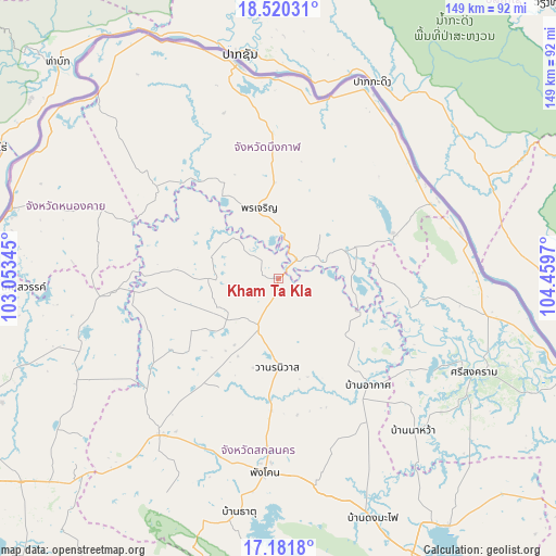
Kham Ta Kla GPS coordinates[2]
17° 51' 8.316" North, 103° 45' 23.652" East
| Map corner | latitude | longitude |
|---|---|---|
| Upper-left | 18.52031°, | 103.05345° |
| Center: | 17.85231°, | 103.75657° |
| Lower-right: | 17.1818°, | 104.4597° |
| Map W x H: | 148.8×148.8 km | = 92.5×92.5mi |
| max Lat: | 20.43353° ⇑12.8% North |
| Kham Ta Kla: | 17.85231° |
| min Lat: | ⇓87.2% South 5.77434° |
| min Long | Kham Ta Kla | max Long |
| 97.93288° | 103.75657° | 105.49506° |
| W 87.8%⇐ | ⇒12.2% E |
Elevation
Elevation of Kham Ta Kla is 165 m = 541 ft, and this is 39.5 m = 130 ft above average elevation for this country.
| Max E: |
1011 m = 3317 ft | 32.1% |
| Kham Ta Kla | 165 m 541 ft | |
| Avg. | 125.5 m = 412 ft | |
Min E: |
1 m = 3 ft | 67.9% |
See also: Thailand elevation on elevation.city.
Geographical zone
Kham Ta Kla is located in North Torrid zone (between Equator and Tropic of Cancer). Distance of this Northern Tropic circle is 620.9 km =385.8 mi to North.| Distance of | km | miles | from Kham Ta Kla |
|---|---|---|---|
| North Pole | 8022.1 | 4984.7 | to North |
| Arctic Circle | 5416.2 | 3365.5 | to North |
| Tropic Cancer | 620.9 | 385.8 | to North |
| Equator | 1985 | 1233.4 | to South |


Nearby cities:
15 places around Kham Ta Kla: (largest is in red/bold)
• Akat Amnuai
37.1 km =23.1 mi,  140°
140°
• Ban Muang
19.8 km =12.3 mi,  269°
269°
• Ban Phaeng
50.1 km =31.1 mi,  75°
75°
• Bueng Khong Long
33 km =20.5 mi,  68°
68°
• Charoen Sin
38 km =23.6 mi,  217°
217°
• Fao Rai
51.3 km =31.9 mi,  291°
291°
• Na Thom
36.2 km =22.5 mi,  101°
101°
• Nathom
36.1 km =22.4 mi, 101°
• Phang Khon
51.5 km =32 mi,  184°
184°
• Phon Charoen
20.5 km =12.7 mi,  346°
346°
• Sawang Daen Din
52.5 km =32.6 mi, 217°
• Seka
22.7 km =14.1 mi, 68°
• Si Wilai
36.7 km =22.8 mi,  358°
358°
• So Phisai
41.5 km =25.8 mi,  307°
307°
• Wanon Niwat
24.3 km =15.1 mi, 181°
Sources, notices
• [Note1] Compared only with cities in Thailand existing in our database
• [Src1] Map data: © OpenStreetMap contributors (CC-BY-SA)
• [Src2] Other city data from geonames.org with taken over terms of usage.
• [Src3] Geographical zone / Annual Mean Temperature by Robert A. Rohde @ Wikipedia
