Song Khwae geodata
Song Khwae (Nan) is a seat of a second-order administrative division; located in Thailand in Asia/Bangkok (GMT+7) time zone. In our database, there are 331 cities with bigger population. Compared to other cities in Thailand, 96.8% of cities are located further ↓South; 51.5% of cities are located further →East and 91.4% of cities have lower elevation than Song Khwae. Note1


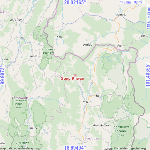
Song Khwae GPS coordinates[2]
19° 21' 34.704" North, 100° 42' 1.512" East
| Map corner | latitude | longitude |
|---|---|---|
| Upper-left | 20.02165°, | 99.9973° |
| Center: | 19.35964°, | 100.70042° |
| Lower-right: | 18.69494°, | 101.40355° |
| Map W x H: | 147.5×147.5 km | = 91.7×91.7mi |
| max Lat: | 20.43353° ⇑3.2% North |
| Song Khwae: | 19.35964° |
| min Lat: | ⇓96.8% South 5.77434° |
| min Long | Song Khwae | max Long |
| 97.93288° | 100.70042° | 105.49506° |
| W 48.5%⇐ | ⇒51.5% E |
Elevation
Elevation of Song Khwae is 299 m = 981 ft, and this is 173.5 m = 569 ft above average elevation for this country.
| Max E: |
1011 m = 3317 ft | 8.6% |
| Song Khwae | 299 m 981 ft | |
| Avg. | 125.5 m = 412 ft | |
Min E: |
1 m = 3 ft | 91.4% |
See also: Thailand elevation on elevation.city.
Geographical zone
Song Khwae is located in North Torrid zone (between Equator and Tropic of Cancer). Distance of this Northern Tropic circle is 453.3 km =281.7 mi to North.| Distance of | km | miles | from Song Khwae |
|---|---|---|---|
| North Pole | 7854.5 | 4880.6 | to North |
| Arctic Circle | 5248.6 | 3261.3 | to North |
| Tropic Cancer | 453.3 | 281.7 | to North |
| Equator | 2152.6 | 1337.6 | to South |


Nearby cities:
15 places around Song Khwae: (largest is in red/bold)
• Ban Luang
63.1 km =39.2 mi,  205°
205°
• Bo Kluea
53.1 km =33 mi,  115°
115°
• Chaloem Phra Kiat
46.7 km =29 mi,  58°
58°
• Chiang Kham
45.8 km =28.5 mi,  293°
293°
• Chiang Klang
18.4 km =11.4 mi,  113°
113°
• Chiang Muan
66.7 km =41.4 mi,  218°
218°
• Chun
59.4 km =36.9 mi,  267°
267°
• Nan
64.6 km =40.1 mi,  172°
172°
• Phu Sang
47.6 km =29.6 mi,  304°
304°
• Pong
50.4 km =31.3 mi,  242°
242°
• Pua
30.6 km =19 mi,  132°
132°
• Santi Suk
55.7 km =34.6 mi,  152°
152°
• Tha Wang Pha
28.9 km =18 mi,  156°
156°
• Thoeng
64.2 km =39.9 mi, 304°
• Thung Chang
18.7 km =11.6 mi,  80°
80°
Sources, notices
• [Note1] Compared only with cities in Thailand existing in our database
• [Src1] Map data: © OpenStreetMap contributors (CC-BY-SA)
• [Src2] Other city data from geonames.org with taken over terms of usage.
• [Src3] Geographical zone / Annual Mean Temperature by Robert A. Rohde @ Wikipedia
