Nan geodata
Nan is a seat of a first-order administrative division; located in Thailand in Asia/Bangkok (GMT+7) time zone. With population of 24,670 people, there are 130 cities with bigger population in this country. Compared to other cities in Thailand, 94.4% of cities are located further ↓South; 50.1% of cities are located further ←West and 82.2% of cities have lower elevation than Nan. Note1


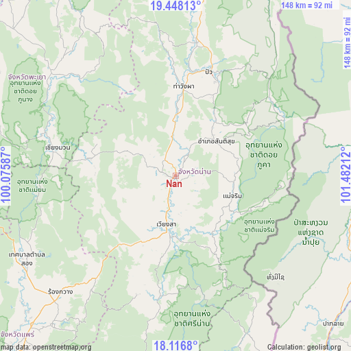
Nan GPS coordinates[2]
18° 47' 1.608" North, 100° 46' 44.364" East
| Map corner | latitude | longitude |
|---|---|---|
| Upper-left | 19.44813°, | 100.07587° |
| Center: | 18.78378°, | 100.77899° |
| Lower-right: | 18.1168°, | 101.48212° |
| Map W x H: | 148×148 km | = 92×92mi |
| max Lat: | 20.43353° ⇑5.6% North |
| Nan: | 18.78378° |
| min Lat: | ⇓94.4% South 5.77434° |
| min Long | Nan | max Long |
| 97.93288° | 100.77899° | 105.49506° |
| W 50.1%⇐ | ⇒49.9% E |
Elevation
Elevation of Nan is 205 m = 673 ft, and this is 79.5 m = 261 ft above average elevation for this country.
| Max E: |
1011 m = 3317 ft | 17.8% |
| Nan | 205 m 673 ft | |
| Avg. | 125.5 m = 412 ft | |
Min E: |
1 m = 3 ft | 82.2% |
See also: Thailand elevation on elevation.city.
Geographical zone
Nan is located in North Torrid zone (between Equator and Tropic of Cancer). Distance of this Northern Tropic circle is 517.4 km =321.5 mi to North.| Distance of | km | miles | from Nan |
|---|---|---|---|
| North Pole | 7918.5 | 4920.3 | to North |
| Arctic Circle | 5312.6 | 3301.1 | to North |
| Tropic Cancer | 517.4 | 321.5 | to North |
| Equator | 2088.6 | 1297.8 | to South |


Nearby cities:
15 places around Nan: (largest is in red/bold)
• Ban Luang
36.7 km =22.8 mi,  281°
281°
• Bo Kluea
56.8 km =35.3 mi,  44°
44°
• Chiang Klang
57.4 km =35.7 mi,  8°
8°
• Chiang Muan
51.2 km =31.8 mi, 283°
• Mae Charim
25.4 km =15.8 mi,  109°
109°
• Na Muen
67.3 km =41.8 mi,  190°
190°
• Na Noi
51.3 km =31.9 mi, 187°
• Phu Phiang
5.1 km =3.2 mi,  154°
154°
• Pong
66.8 km =41.5 mi,  307°
307°
• Pua
45.8 km =28.5 mi,  18°
18°
• Santi Suk
22.4 km =13.9 mi,  49°
49°
• Song Khwae
64.6 km =40.1 mi,  352°
352°
• Tha Wang Pha
37.7 km =23.4 mi, 5°
• Thung Chang
67.9 km =42.2 mi, 8°
• Wiang Sa
21 km =13 mi, 190°
Sources, notices
• [Note1] Compared only with cities in Thailand existing in our database
• [Src1] Map data: © OpenStreetMap contributors (CC-BY-SA)
• [Src2] Other city data from geonames.org with taken over terms of usage.
• [Src3] Geographical zone / Annual Mean Temperature by Robert A. Rohde @ Wikipedia
