Sidi Alouane geodata
Sidi Alouane (Al Mahdīyah) is a populated place; located in Tunisia in Africa/Tunis (GMT+1) time zone. With population of 7,051 people, there are 101 cities with bigger population in this country. Compared to other cities in Tunisia, 71.3% of cities are located further ↑North; 90.9% of cities are located further ←West and 55.9% of cities have lower elevation than Sidi Alouane. Note1


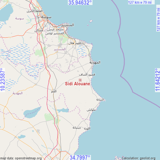
Sidi Alouane GPS coordinates[2]
35° 22' 30.18" North, 10° 56' 20.364" East
| Map corner | latitude | longitude |
|---|---|---|
| Upper-left | 35.94632°, | 10.23587° |
| Center: | 35.37505°, | 10.93899° |
| Lower-right: | 34.7997°, | 11.64212° |
| Map W x H: | 127.5×127.5 km | = 79.2×79.2mi |
| max Lat: | 37.27442° ⇑71.3% North |
| Sidi Alouane: | 35.37505° |
| min Lat: | ⇓28.7% South 32.31662° |
| min Long | Sidi Alouane | max Long |
| 7.87765° | 10.93899° | 11.21965° |
| W 90.9%⇐ | ⇒9.1% E |
Elevation
Elevation of Sidi Alouane is 58 m = 190 ft, and this is 91.4 m = 300 ft below average elevation for this country.
| Max E: |
999 m = 3278 ft | 44.1% |
| Avg. | 149.4 m = 490 ft | |
| Sidi Alouane | 58 m = 190 ft | |
Min E: |
-6 m = -20 ft | 55.9% |
See also: Tunisia elevation on elevation.city.
Geographical zone
Sidi Alouane is located in North temperate zone (between Tropic of Cancer and the Arctic Circle). Distance of this Northern Tropic circle is 1327.4 km =824.8 mi to South.| Distance of | km | miles | from Sidi Alouane |
|---|---|---|---|
| North Pole | 6073.7 | 3774 | to North |
| Arctic Circle | 3467.8 | 2154.8 | to North |
| Tropic Cancer | 1327.4 | 824.8 | to South |
| Equator | 3933.3 | 2444 | to South |


Nearby cities:
15 places around Sidi Alouane: (largest is in red/bold)
• Bekalta
27.4 km =17 mi,  10°
10°
• Beni Hassane
24.4 km =15.2 mi,  331°
331°
• Chebba
22.1 km =13.7 mi,  133°
133°
• Djemmal
32.1 km =19.9 mi, 329°
• El Jem
21.8 km =13.5 mi,  247°
247°
• Ksar Hellal
30.6 km =19 mi,  351°
351°
• Ksour Essaf
7 km =4.3 mi,  46°
46°
• Lemta
32.8 km =20.4 mi, 351°
• Mahdia
18.2 km =11.3 mi,  37°
37°
• Melloulèche
24.8 km =15.4 mi,  159°
159°
• Salakta
9.7 km =6 mi,  77°
77°
• Seïada
32.9 km =20.4 mi, 352°
• Sidi Ben Nour
17.7 km =11 mi, 353°
• Touza
30.7 km =19.1 mi,  340°
340°
• Zouila
17.8 km =11.1 mi, 38°
Sources, notices
• [Note1] Compared only with cities in Tunisia existing in our database
• [Src1] Map data: © OpenStreetMap contributors (CC-BY-SA)
• [Src2] Other city data from geonames.org with taken over terms of usage.
• [Src3] Geographical zone / Annual Mean Temperature by Robert A. Rohde @ Wikipedia
