Manouba geodata
Manouba is a seat of a first-order administrative division; located in Tunisia in Africa/Tunis (GMT+1) time zone. With population of 24,948 people, there are 50 cities with bigger population in this country. Compared to other cities in Tunisia, 83.2% of cities are located further ↓South; 55.2% of cities are located further →East and 57.3% of cities have higher elevation than Manouba. Note1


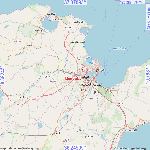
Manouba GPS coordinates[2]
36° 48' 36.216" North, 10° 5' 44.052" East
| Map corner | latitude | longitude |
|---|---|---|
| Upper-left | 37.37093°, | 9.39245° |
| Center: | 36.81006°, | 10.09557° |
| Lower-right: | 36.24505°, | 10.7987° |
| Map W x H: | 125.2×125.2 km | = 77.8×77.8mi |
| max Lat: | 37.27442° ⇑16.8% North |
| Manouba: | 36.81006° |
| min Lat: | ⇓83.2% South 32.31662° |
| min Long | Manouba | max Long |
| 7.87765° | 10.09557° | 11.21965° |
| W 44.8%⇐ | ⇒55.2% E |
Elevation
Elevation of Manouba is 35 m = 115 ft, and this is 114.4 m = 375 ft below average elevation for this country.
| Max E: |
999 m = 3278 ft | 57.3% |
| Avg. | 149.4 m = 490 ft | |
| Manouba | 35 m = 115 ft | |
Min E: |
-6 m = -20 ft | 42.7% |
See also: Tunisia elevation on elevation.city.
Geographical zone
Manouba is located in North temperate zone (between Tropic of Cancer and the Arctic Circle). Distance of this Northern Tropic circle is 1487 km =924 mi to South.| Distance of | km | miles | from Manouba |
|---|---|---|---|
| North Pole | 5914.2 | 3674.9 | to North |
| Arctic Circle | 3308.3 | 2055.7 | to North |
| Tropic Cancer | 1487 | 924 | to South |
| Equator | 4092.9 | 2543.2 | to South |


Nearby cities:
15 places around Manouba: (largest is in red/bold)
• Al Marsá
21.7 km =13.5 mi,  69°
69°
• Ariana
10.3 km =6.4 mi,  57°
57°
• Ben Arous
12.8 km =8 mi,  118°
118°
• Carthage
21.8 km =13.5 mi, 74°
• El Battan
22.4 km =13.9 mi,  268°
268°
• Galaat el Andeless
28.2 km =17.5 mi,  4°
4°
• Hammam-Lif
23.7 km =14.7 mi,  112°
112°
• La Goulette
18.7 km =11.6 mi,  87°
87°
• La Mohammedia
16 km =9.9 mi,  160°
160°
• La Sebala du Mornag
22.7 km =14.1 mi,  129°
129°
• Oued Lill
5.6 km =3.5 mi,  298°
298°
• Radès
16.6 km =10.3 mi, 105°
• Sidi Bou Saïd
22.9 km =14.2 mi, 73°
• Tunis
6.3 km =3.9 mi,  80°
80°
• Zahānah
26 km =16.2 mi,  348°
348°
Sources, notices
• [Note1] Compared only with cities in Tunisia existing in our database
• [Src1] Map data: © OpenStreetMap contributors (CC-BY-SA)
• [Src2] Other city data from geonames.org with taken over terms of usage.
• [Src3] Geographical zone / Annual Mean Temperature by Robert A. Rohde @ Wikipedia
