El Battan geodata
El Battan (Manouba) is a populated place; located in Tunisia in Africa/Tunis (GMT+1) time zone. With population of 6,047 people, there are 112 cities with bigger population in this country. Compared to other cities in Tunisia, 82.5% of cities are located further ↓South; 64.3% of cities are located further →East and 58% of cities have higher elevation than El Battan. Note1


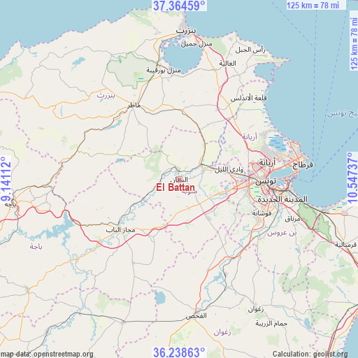
El Battan GPS coordinates[2]
36° 48' 13.248" North, 9° 50' 39.264" East
| Map corner | latitude | longitude |
|---|---|---|
| Upper-left | 37.36459°, | 9.14112° |
| Center: | 36.80368°, | 9.84424° |
| Lower-right: | 36.23863°, | 10.54737° |
| Map W x H: | 125.2×125.2 km | = 77.8×77.8mi |
| max Lat: | 37.27442° ⇑17.5% North |
| El Battan: | 36.80368° |
| min Lat: | ⇓82.5% South 32.31662° |
| min Long | El Battan | max Long |
| 7.87765° | 9.84424° | 11.21965° |
| W 35.7%⇐ | ⇒64.3% E |
Elevation
Elevation of El Battan is 34 m = 112 ft, and this is 115.4 m = 379 ft below average elevation for this country.
| Max E: |
999 m = 3278 ft | 58% |
| Avg. | 149.4 m = 490 ft | |
| El Battan | 34 m = 112 ft | |
Min E: |
-6 m = -20 ft | 42% |
See also: Tunisia elevation on elevation.city.
Geographical zone
El Battan is located in North temperate zone (between Tropic of Cancer and the Arctic Circle). Distance of this Northern Tropic circle is 1486.3 km =923.5 mi to South.| Distance of | km | miles | from El Battan |
|---|---|---|---|
| North Pole | 5914.9 | 3675.3 | to North |
| Arctic Circle | 3309 | 2056.1 | to North |
| Tropic Cancer | 1486.3 | 923.5 | to South |
| Equator | 4092.2 | 2542.8 | to South |


Nearby cities:
15 places around El Battan: (largest is in red/bold)
• Ariana
31.7 km =19.7 mi,  78°
78°
• Ben Arous
34.1 km =21.2 mi,  99°
99°
• Douar Tindja
41.2 km =25.6 mi,  348°
348°
• Galaat el Andeless
37.7 km =23.4 mi,  40°
40°
• Goubellat
33.3 km =20.7 mi,  208°
208°
• La Goulette
41.1 km =25.5 mi,  87°
87°
• La Mohammedia
31.3 km =19.4 mi,  117°
117°
• Manouba
22.4 km =13.9 mi, 88°
• Mateur
30.7 km =19.1 mi,  328°
328°
• Medjez el Bab
26.8 km =16.7 mi,  230°
230°
• Menzel Bourguiba
39.3 km =24.4 mi, 352°
• Oued Lill
17.8 km =11.1 mi, 79°
• Radès
38.5 km =23.9 mi, 95°
• Tunis
28.7 km =17.8 mi, 86°
• Zahānah
31.4 km =19.5 mi,  33°
33°
Sources, notices
• [Note1] Compared only with cities in Tunisia existing in our database
• [Src1] Map data: © OpenStreetMap contributors (CC-BY-SA)
• [Src2] Other city data from geonames.org with taken over terms of usage.
• [Src3] Geographical zone / Annual Mean Temperature by Robert A. Rohde @ Wikipedia
