Rhar el Melah geodata
Rhar el Melah (Banzart) is a populated place; located in Tunisia in Africa/Tunis (GMT+1) time zone. With population of 5,018 people, there are 118 cities with bigger population in this country. Compared to other cities in Tunisia, 96.5% of cities are located further ↓South; 50.3% of cities are located further ←West and 85.3% of cities have higher elevation than Rhar el Melah. Note1


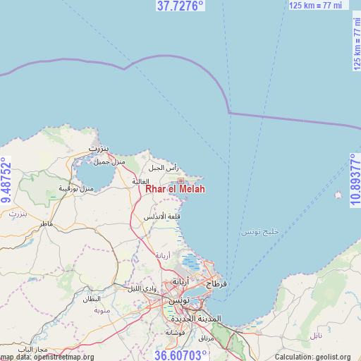
Rhar el Melah GPS coordinates[2]
37° 10' 9.804" North, 10° 11' 26.304" East
| Map corner | latitude | longitude |
|---|---|---|
| Upper-left | 37.7276°, | 9.48752° |
| Center: | 37.16939°, | 10.19064° |
| Lower-right: | 36.60703°, | 10.89377° |
| Map W x H: | 124.6×124.6 km | = 77.4×77.4mi |
| max Lat: | 37.27442° ⇑3.5% North |
| Rhar el Melah: | 37.16939° |
| min Lat: | ⇓96.5% South 32.31662° |
| min Long | Rhar el Melah | max Long |
| 7.87765° | 10.19064° | 11.21965° |
| W 50.3%⇐ | ⇒49.7% E |
Elevation
Elevation of Rhar el Melah is 10 m = 33 ft, and this is 139.4 m = 457 ft below average elevation for this country.
| Max E: |
999 m = 3278 ft | 85.3% |
| Avg. | 149.4 m = 490 ft | |
| Rhar el Melah | 10 m = 33 ft | |
Min E: |
-6 m = -20 ft | 14.7% |
See also: Tunisia elevation on elevation.city.
Geographical zone
Rhar el Melah is located in North temperate zone (between Tropic of Cancer and the Arctic Circle). Distance of this Northern Tropic circle is 1526.9 km =948.8 mi to South.| Distance of | km | miles | from Rhar el Melah |
|---|---|---|---|
| North Pole | 5874.2 | 3650.1 | to North |
| Arctic Circle | 3268.3 | 2030.8 | to North |
| Tropic Cancer | 1526.9 | 948.8 | to South |
| Equator | 4132.8 | 2568 | to South |


Nearby cities:
15 places around Rhar el Melah: (largest is in red/bold)
• Al Marsá
34.5 km =21.4 mi,  159°
159°
• Al Matlīn
15 km =9.3 mi,  304°
304°
• Ariana
34.4 km =21.4 mi,  179°
179°
• Bizerte
30.4 km =18.9 mi,  292°
292°
• Carthage
36.5 km =22.7 mi, 159°
• Douar Tindja
39 km =24.2 mi,  269°
269°
• El Alia
13.8 km =8.6 mi, 269°
• Galaat el Andeless
13.5 km =8.4 mi,  208°
208°
• Menzel Abderhaman
30 km =18.6 mi,  284°
284°
• Menzel Bourguiba
35.9 km =22.3 mi, 267°
• Menzel Jemil
25.6 km =15.9 mi, 286°
• Rafrāf
2.4 km =1.5 mi,  345°
345°
• Sidi Bou Saïd
36 km =22.4 mi, 158°
• Tunis
39 km =24.2 mi, 183°
• Zahānah
19.7 km =12.2 mi,  223°
223°
Sources, notices
• [Note1] Compared only with cities in Tunisia existing in our database
• [Src1] Map data: © OpenStreetMap contributors (CC-BY-SA)
• [Src2] Other city data from geonames.org with taken over terms of usage.
• [Src3] Geographical zone / Annual Mean Temperature by Robert A. Rohde @ Wikipedia
