Al Matlīn geodata
Al Matlīn (Banzart) is a populated place; located in Tunisia in Africa/Tunis (GMT+1) time zone. With population of 7,370 people, there are 97 cities with bigger population in this country. Compared to other cities in Tunisia, 99.3% of cities are located further ↓South; 57.3% of cities are located further →East and 75.5% of cities have lower elevation than Al Matlīn. Note1


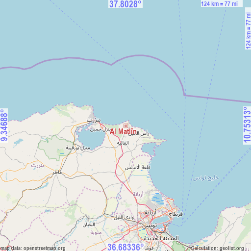
Al Matlīn GPS coordinates[2]
37° 14' 42.576" North, 10° 3' 0" East
| Map corner | latitude | longitude |
|---|---|---|
| Upper-left | 37.8028°, | 9.34688° |
| Center: | 37.24516°, | 10.05° |
| Lower-right: | 36.68336°, | 10.75313° |
| Map W x H: | 124.5×124.5 km | = 77.4×77.4mi |
| max Lat: | 37.27442° ⇑0.7% North |
| Al Matlīn: | 37.24516° |
| min Lat: | ⇓99.3% South 32.31662° |
| min Long | Al Matlīn | max Long |
| 7.87765° | 10.05° | 11.21965° |
| W 42.7%⇐ | ⇒57.3% E |
Elevation
Elevation of Al Matlīn is 180 m = 591 ft, and this is 30.6 m = 100 ft above average elevation for this country.
| Max E: |
999 m = 3278 ft | 24.5% |
| Al Matlīn | 180 m 591 ft | |
| Avg. | 149.4 m = 490 ft | |
Min E: |
-6 m = -20 ft | 75.5% |
See also: Tunisia elevation on elevation.city.
Geographical zone
Al Matlīn is located in North temperate zone (between Tropic of Cancer and the Arctic Circle). Distance of this Northern Tropic circle is 1535.4 km =954.1 mi to South.| Distance of | km | miles | from Al Matlīn |
|---|---|---|---|
| North Pole | 5865.8 | 3644.8 | to North |
| Arctic Circle | 3259.9 | 2025.6 | to North |
| Tropic Cancer | 1535.4 | 954.1 | to South |
| Equator | 4141.3 | 2573.3 | to South |


Nearby cities:
15 places around Al Matlīn: (largest is in red/bold)
• Al Marsá
47.5 km =29.5 mi,  149°
149°
• Ariana
44.7 km =27.8 mi,  163°
163°
• Bizerte
15.9 km =9.9 mi,  281°
281°
• Douar Tindja
28 km =17.4 mi,  251°
251°
• El Alia
8.6 km =5.3 mi,  189°
189°
• Galaat el Andeless
21.1 km =13.1 mi, 163°
• Mateur
41 km =25.5 mi,  236°
236°
• Menzel Abderhaman
16.6 km =10.3 mi,  267°
267°
• Menzel Bourguiba
25.5 km =15.8 mi, 246°
• Menzel Jemil
12 km =7.5 mi, 265°
• Oued Lill
45.7 km =28.4 mi,  181°
181°
• Rafrāf
13.3 km =8.3 mi,  117°
117°
• Rhar el Melah
15 km =9.3 mi, 124°
• Tunis
48.5 km =30.1 mi,  167°
167°
• Zahānah
22.9 km =14.2 mi, 182°
Sources, notices
• [Note1] Compared only with cities in Tunisia existing in our database
• [Src1] Map data: © OpenStreetMap contributors (CC-BY-SA)
• [Src2] Other city data from geonames.org with taken over terms of usage.
• [Src3] Geographical zone / Annual Mean Temperature by Robert A. Rohde @ Wikipedia
