Bizerte geodata
Bizerte (Banzart) is a seat of a first-order administrative division; located in Tunisia in Africa/Tunis (GMT+1) time zone. With population of 115,268 people, there are 4 cities with bigger population in this country. Compared to other cities in Tunisia, 100% of cities are located further ↓South; 62.9% of cities are located further →East and 94.4% of cities have higher elevation than Bizerte. Note1


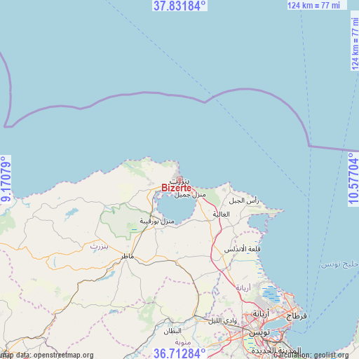
Bizerte GPS coordinates[2]
37° 16' 27.912" North, 9° 52' 26.076" East
| Map corner | latitude | longitude |
|---|---|---|
| Upper-left | 37.83184°, | 9.17079° |
| Center: | 37.27442°, | 9.87391° |
| Lower-right: | 36.71284°, | 10.57704° |
| Map W x H: | 124.4×124.4 km | = 77.3×77.3mi |
| max Lat: | 37.27442° ⇑0% North |
| Bizerte: | 37.27442° |
| min Lat: | ⇓100% South 32.31662° |
| min Long | Bizerte | max Long |
| 7.87765° | 9.87391° | 11.21965° |
| W 37.1%⇐ | ⇒62.9% E |
Elevation
Elevation of Bizerte is 5 m = 16 ft, and this is 144.4 m = 474 ft below average elevation for this country.
| Max E: |
999 m = 3278 ft | 94.4% |
| Avg. | 149.4 m = 490 ft | |
| Bizerte | 5 m = 16 ft | |
Min E: |
-6 m = -20 ft | 5.6% |
See also: Bizerte elevation on elevation.city.
Geographical zone
Bizerte is located in North temperate zone (between Tropic of Cancer and the Arctic Circle). Distance of this Northern Tropic circle is 1538.6 km =956 mi to South.| Distance of | km | miles | from Bizerte |
|---|---|---|---|
| North Pole | 5862.5 | 3642.8 | to North |
| Arctic Circle | 3256.6 | 2023.6 | to North |
| Tropic Cancer | 1538.6 | 956 | to South |
| Equator | 4144.5 | 2575.3 | to South |


Nearby cities:
15 places around Bizerte: (largest is in red/bold)
• Al Matlīn
15.9 km =9.9 mi,  101°
101°
• Ariana
54.1 km =33.6 mi,  148°
148°
• Douar Tindja
16.2 km =10.1 mi,  222°
222°
• El Alia
18.4 km =11.4 mi,  129°
129°
• El Battan
52.4 km =32.6 mi,  182°
182°
• Galaat el Andeless
32 km =19.9 mi,  137°
137°
• Manouba
55.3 km =34.4 mi,  159°
159°
• Mateur
31.9 km =19.8 mi, 215°
• Menzel Abderhaman
4.2 km =2.6 mi,  193°
193°
• Menzel Bourguiba
15.5 km =9.6 mi,  210°
210°
• Menzel Jemil
5.6 km =3.5 mi, 139°
• Oued Lill
51.1 km =31.8 mi, 163°
• Rafrāf
29 km =18 mi,  108°
108°
• Rhar el Melah
30.4 km =18.9 mi, 112°
• Zahānah
29.9 km =18.6 mi, 150°
In other languages:
- In Spanish: Bizerta
- In German: Bizerta
- In Italian: Biserta
- In Russian: Бизерта
- In Chinese: 比塞大
Sources, notices
• [Note1] Compared only with cities in Tunisia existing in our database
• [Src1] Map data: © OpenStreetMap contributors (CC-BY-SA)
• [Src2] Other city data from geonames.org with taken over terms of usage.
• [Src3] Geographical zone / Annual Mean Temperature by Robert A. Rohde @ Wikipedia
