Arıköy geodata
Arıköy (Istanbul) is a populated place; located in Turkey in Europe/Istanbul (GMT+3) time zone. With population of 2,000 people, there are 956 cities with bigger population in this country. Compared to other cities in Turkey, 94.8% of cities are located further ↓South; 83.9% of cities are located further →East and 86% of cities have higher elevation than Arıköy. Note1


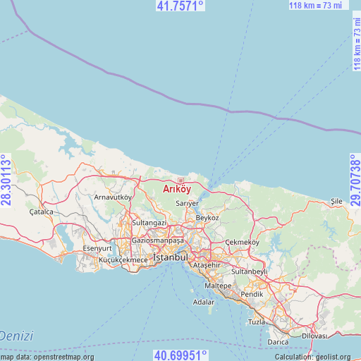
Arıköy GPS coordinates[2]
41° 13' 49.584" North, 29° 0' 15.3" East
| Map corner | latitude | longitude |
|---|---|---|
| Upper-left | 41.7571°, | 28.30113° |
| Center: | 41.23044°, | 29.00425° |
| Lower-right: | 40.69951°, | 29.70738° |
| Map W x H: | 117.6×117.6 km | = 73.1×73.1mi |
| max Lat: | 42.02683° ⇑5.2% North |
| Arıköy: | 41.23044° |
| min Lat: | ⇓94.8% South 35.9025° |
| min Long | Arıköy | max Long |
| 25.90902° | 29.00425° | 44.60099° |
| W 16.1%⇐ | ⇒83.9% E |
Elevation
Elevation of Arıköy is 65 m = 213 ft, and this is 652.4 m = 2140 ft below average elevation for this country.
| Max E: |
2682 m = 8799 ft | 86% |
| Avg. | 717.4 m = 2354 ft | |
| Arıköy | 65 m = 213 ft | |
Min E: |
0 m = 0 ft | 14% |
See also: Turkey elevation on elevation.city.
Geographical zone
Arıköy is located in North temperate zone (between Tropic of Cancer and the Arctic Circle). Distance of this Northern Tropic circle is 1978.5 km =1229.4 mi to South.| Distance of | km | miles | from Arıköy |
|---|---|---|---|
| North Pole | 5422.7 | 3369.5 | to North |
| Arctic Circle | 2816.8 | 1750.3 | to North |
| Tropic Cancer | 1978.5 | 1229.4 | to South |
| Equator | 4584.4 | 2848.6 | to South |


Nearby cities:
15 places around Arıköy: (largest is in red/bold)
• Arnavutköy
22.7 km =14.1 mi,  256°
256°
• Bağcılar
24.6 km =15.3 mi,  210°
210°
• Başakşehir
22.8 km =14.2 mi,  227°
227°
• Eminönü
23.8 km =14.8 mi,  186°
186°
• Esenler
23.4 km =14.5 mi, 207°
• Istanbul
24.5 km =15.2 mi, 190°
• Kemerburgaz
10.9 km =6.8 mi,  223°
223°
• Mahmut Şevket Paşa
17.8 km =11.1 mi,  119°
119°
• Mahmutbey
24.7 km =15.3 mi, 217°
• Sultangazi
17.9 km =11.1 mi, 219°
• Umraniye
25.8 km =16 mi,  157°
157°
• Çekmeköy
25.6 km =15.9 mi,  145°
145°
• Ümraniye
23.4 km =14.5 mi, 159°
• Üsküdar
23.1 km =14.4 mi,  178°
178°
• Şişli
19 km =11.8 mi, 184°
Sources, notices
• [Note1] Compared only with cities in Turkey existing in our database
• [Src1] Map data: © OpenStreetMap contributors (CC-BY-SA)
• [Src2] Other city data from geonames.org with taken over terms of usage.
• [Src3] Geographical zone / Annual Mean Temperature by Robert A. Rohde @ Wikipedia
