Yenifoça geodata
Yenifoça (İzmir) is a seat of a third-order administrative division; located in Turkey in Europe/Istanbul (GMT+3) time zone. With population of 3,742 people, there are 803 cities with bigger population in this country. Compared to other cities in Turkey, 50.6% of cities are located further ↓South; 97.8% of cities are located further →East and 94.8% of cities have higher elevation than Yenifoça. Note1


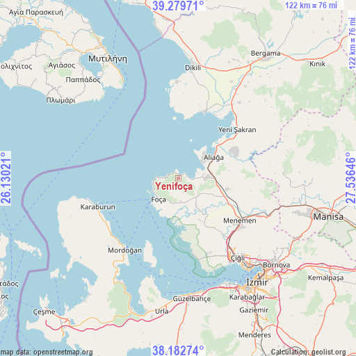
Yenifoça GPS coordinates[2]
38° 43' 59.988" North, 26° 49' 59.988" East
| Map corner | latitude | longitude |
|---|---|---|
| Upper-left | 39.27971°, | 26.13021° |
| Center: | 38.73333°, | 26.83333° |
| Lower-right: | 38.18274°, | 27.53646° |
| Map W x H: | 122×122 km | = 75.8×75.8mi |
| max Lat: | 42.02683° ⇑49.4% North |
| Yenifoça: | 38.73333° |
| min Lat: | ⇓50.6% South 35.9025° |
| min Long | Yenifoça | max Long |
| 25.90902° | 26.83333° | 44.60099° |
| W 2.2%⇐ | ⇒97.8% E |
Elevation
Elevation of Yenifoça is 17 m = 56 ft, and this is 700.4 m = 2298 ft below average elevation for this country.
| Max E: |
2682 m = 8799 ft | 94.8% |
| Avg. | 717.4 m = 2354 ft | |
| Yenifoça | 17 m = 56 ft | |
Min E: |
0 m = 0 ft | 5.2% |
See also: Turkey elevation on elevation.city.
Geographical zone
Yenifoça is located in North temperate zone (between Tropic of Cancer and the Arctic Circle). Distance of this Northern Tropic circle is 1700.8 km =1056.8 mi to South.| Distance of | km | miles | from Yenifoça |
|---|---|---|---|
| North Pole | 5700.3 | 3542 | to North |
| Arctic Circle | 3094.4 | 1922.8 | to North |
| Tropic Cancer | 1700.8 | 1056.8 | to South |
| Equator | 4306.7 | 2676.1 | to South |


Nearby cities:
15 places around Yenifoça: (largest is in red/bold)
• Aliağa
14.1 km =8.8 mi,  58°
58°
• Bayraklı
41.2 km =25.6 mi,  135°
135°
• Denizgiren
43 km =26.7 mi,  242°
242°
• Dikili
37.9 km =23.5 mi,  7°
7°
• Emiralem
30.4 km =18.9 mi,  116°
116°
• Foça
9.7 km =6 mi,  223°
223°
• Karaburun
30 km =18.6 mi,  248°
248°
• Karşıyaka
39 km =24.2 mi, 141°
• Menemen
24.8 km =15.4 mi, 124°
• Mordoğan
30.2 km =18.8 mi, 216°
• Osmancalı
36.5 km =22.7 mi,  84°
84°
• Yenişakran
26.4 km =16.4 mi,  49°
49°
• Yuntdağ
39.6 km =24.6 mi, 56°
• Zeytindağ
33.2 km =20.6 mi,  38°
38°
• Çandarlı
24.1 km =15 mi,  21°
21°
Sources, notices
• [Note1] Compared only with cities in Turkey existing in our database
• [Src1] Map data: © OpenStreetMap contributors (CC-BY-SA)
• [Src2] Other city data from geonames.org with taken over terms of usage.
• [Src3] Geographical zone / Annual Mean Temperature by Robert A. Rohde @ Wikipedia
