Karaburun geodata
Karaburun (İzmir) is a seat of a second-order administrative division; located in Turkey in Europe/Istanbul (GMT+3) time zone. With population of 3,249 people, there are 843 cities with bigger population in this country. Compared to other cities in Turkey, 51.1% of cities are located further ↑North; 99.1% of cities are located further →East and 83.9% of cities have higher elevation than Karaburun. Note1


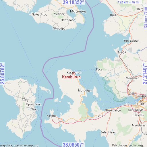
Karaburun GPS coordinates[2]
38° 38' 11.04" North, 26° 30' 39.384" East
| Map corner | latitude | longitude |
|---|---|---|
| Upper-left | 39.18352°, | 25.80782° |
| Center: | 38.6364°, | 26.51094° |
| Lower-right: | 38.08507°, | 27.21407° |
| Map W x H: | 122.1×122.1 km | = 75.9×75.9mi |
| max Lat: | 42.02683° ⇑51.1% North |
| Karaburun: | 38.6364° |
| min Lat: | ⇓48.9% South 35.9025° |
| min Long | Karaburun | max Long |
| 25.90902° | 26.51094° | 44.60099° |
| W 0.9%⇐ | ⇒99.1% E |
Elevation
Elevation of Karaburun is 81 m = 266 ft, and this is 636.4 m = 2088 ft below average elevation for this country.
| Max E: |
2682 m = 8799 ft | 83.9% |
| Avg. | 717.4 m = 2354 ft | |
| Karaburun | 81 m = 266 ft | |
Min E: |
0 m = 0 ft | 16.1% |
See also: Turkey elevation on elevation.city.
Geographical zone
Karaburun is located in North temperate zone (between Tropic of Cancer and the Arctic Circle). Distance of this Northern Tropic circle is 1690 km =1050.1 mi to South.| Distance of | km | miles | from Karaburun |
|---|---|---|---|
| North Pole | 5711.1 | 3548.7 | to North |
| Arctic Circle | 3105.2 | 1929.5 | to North |
| Tropic Cancer | 1690 | 1050.1 | to South |
| Equator | 4296 | 2669.4 | to South |


Nearby cities:
15 places around Karaburun: (largest is in red/bold)
• Alaçatı
41.1 km =25.5 mi,  196°
196°
• Aliağa
43.9 km =27.3 mi,  65°
65°
• Denizgiren
13.5 km =8.4 mi,  229°
229°
• Emiralem
55.2 km =34.3 mi,  93°
93°
• Foça
21.7 km =13.5 mi,  79°
79°
• Karşıyaka
55.8 km =34.7 mi,  110°
110°
• Menemen
48.6 km =30.2 mi, 93°
• Mordoğan
16.6 km =10.3 mi,  143°
143°
• Seferihisar
56.5 km =35.1 mi,  149°
149°
• Urla
41.2 km =25.6 mi, 147°
• Uzunkuyu
39.9 km =24.8 mi,  175°
175°
• Yenifoça
30 km =18.6 mi, 68°
• Yenişakran
55.6 km =34.5 mi,  60°
60°
• Çandarlı
49.5 km =30.8 mi,  47°
47°
• Çeşme
38.8 km =24.1 mi,  207°
207°
Sources, notices
• [Note1] Compared only with cities in Turkey existing in our database
• [Src1] Map data: © OpenStreetMap contributors (CC-BY-SA)
• [Src2] Other city data from geonames.org with taken over terms of usage.
• [Src3] Geographical zone / Annual Mean Temperature by Robert A. Rohde @ Wikipedia
