Şenyurt geodata
Şenyurt (Mardin) is a seat of a third-order administrative division; located in Turkey in Europe/Istanbul (GMT+3) time zone. With population of 1,950 people, there are 965 cities with bigger population in this country. Compared to other cities in Turkey, 86.6% of cities are located further ↑North; 77.6% of cities are located further ←West and 62% of cities have higher elevation than Şenyurt. Note1


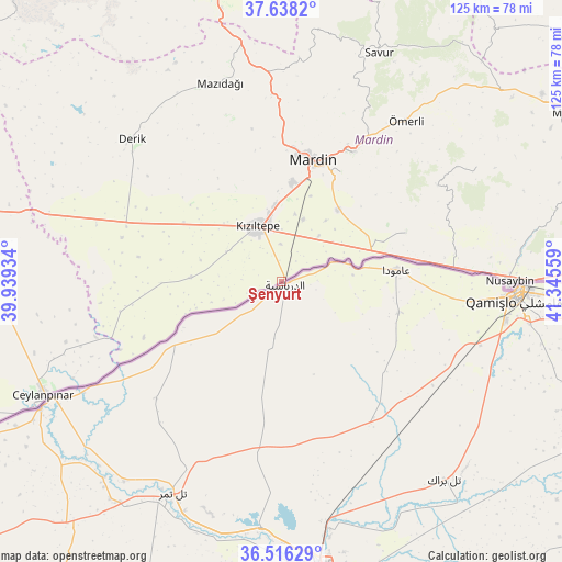
Şenyurt GPS coordinates[2]
37° 4' 45.552" North, 40° 38' 32.856" East
| Map corner | latitude | longitude |
|---|---|---|
| Upper-left | 37.6382°, | 39.93934° |
| Center: | 37.07932°, | 40.64246° |
| Lower-right: | 36.51629°, | 41.34559° |
| Map W x H: | 124.7×124.7 km | = 77.5×77.5mi |
| max Lat: | 42.02683° ⇑86.6% North |
| Şenyurt: | 37.07932° |
| min Lat: | ⇓13.4% South 35.9025° |
| min Long | Şenyurt | max Long |
| 25.90902° | 40.64246° | 44.60099° |
| W 77.6%⇐ | ⇒22.4% E |
Elevation
Elevation of Şenyurt is 472 m = 1549 ft, and this is 245.4 m = 805 ft below average elevation for this country.
| Max E: |
2682 m = 8799 ft | 62% |
| Avg. | 717.4 m = 2354 ft | |
| Şenyurt | 472 m = 1549 ft | |
Min E: |
0 m = 0 ft | 38% |
See also: Turkey elevation on elevation.city.
Geographical zone
Şenyurt is located in North temperate zone (between Tropic of Cancer and the Arctic Circle). Distance of this Northern Tropic circle is 1516.9 km =942.6 mi to South.| Distance of | km | miles | from Şenyurt |
|---|---|---|---|
| North Pole | 5884.2 | 3656.3 | to North |
| Arctic Circle | 3278.3 | 2037 | to North |
| Tropic Cancer | 1516.9 | 942.6 | to South |
| Equator | 4122.8 | 2561.8 | to South |


Nearby cities:
15 places around Şenyurt: (largest is in red/bold)
• Akyazı
11.4 km =7.1 mi,  323°
323°
• Boztepe
13.4 km =8.3 mi,  30°
30°
• Doyuran
4.9 km =3 mi,  354°
354°
• Elbeyli
11.6 km =7.2 mi,  0°
0°
• Eymirli
10.9 km =6.8 mi,  21°
21°
• Eşme
8.5 km =5.3 mi,  359°
359°
• Gyundyukoru
14.3 km =8.9 mi,  299°
299°
• Hatunlu
11.9 km =7.4 mi,  55°
55°
• Karakuyu
12.5 km =7.8 mi, 315°
• Kumlu
13.2 km =8.2 mi,  38°
38°
• Kyanisipi
9 km =5.6 mi,  306°
306°
• Kızıltepe
13.4 km =8.3 mi,  334°
334°
• Selah
14.8 km =9.2 mi, 19°
• Shaklan
14.6 km =9.1 mi,  51°
51°
• Yaşarköy
8.9 km =5.5 mi,  273°
273°
Sources, notices
• [Note1] Compared only with cities in Turkey existing in our database
• [Src1] Map data: © OpenStreetMap contributors (CC-BY-SA)
• [Src2] Other city data from geonames.org with taken over terms of usage.
• [Src3] Geographical zone / Annual Mean Temperature by Robert A. Rohde @ Wikipedia
