Pazarköy geodata
Pazarköy (Canakkale) is a seat of a third-order administrative division; located in Turkey in Europe/Istanbul (GMT+3) time zone. In our database, there are 1323 cities with bigger population. Compared to other cities in Turkey, 66.6% of cities are located further ↓South; 94.2% of cities are located further →East and 74.7% of cities have higher elevation than Pazarköy. Note1


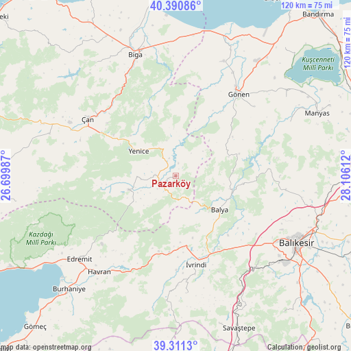
Pazarköy GPS coordinates[2]
39° 51' 11.52" North, 27° 24' 10.764" East
| Map corner | latitude | longitude |
|---|---|---|
| Upper-left | 40.39086°, | 26.69987° |
| Center: | 39.8532°, | 27.40299° |
| Lower-right: | 39.3113°, | 28.10612° |
| Map W x H: | 120×120 km | = 74.6×74.6mi |
| max Lat: | 42.02683° ⇑33.4% North |
| Pazarköy: | 39.8532° |
| min Lat: | ⇓66.6% South 35.9025° |
| min Long | Pazarköy | max Long |
| 25.90902° | 27.40299° | 44.60099° |
| W 5.8%⇐ | ⇒94.2% E |
Elevation
Elevation of Pazarköy is 180 m = 591 ft, and this is 537.4 m = 1763 ft below average elevation for this country.
| Max E: |
2682 m = 8799 ft | 74.7% |
| Avg. | 717.4 m = 2354 ft | |
| Pazarköy | 180 m = 591 ft | |
Min E: |
0 m = 0 ft | 25.3% |
See also: Turkey elevation on elevation.city.
Geographical zone
Pazarköy is located in North temperate zone (between Tropic of Cancer and the Arctic Circle). Distance of this Northern Tropic circle is 1825.3 km =1134.2 mi to South.| Distance of | km | miles | from Pazarköy |
|---|---|---|---|
| North Pole | 5575.8 | 3464.6 | to North |
| Arctic Circle | 2969.9 | 1845.4 | to North |
| Tropic Cancer | 1825.3 | 1134.2 | to South |
| Equator | 4431.3 | 2753.5 | to South |


Nearby cities:
15 places around Pazarköy: (largest is in red/bold)
• Balya
19 km =11.8 mi,  127°
127°
• Danişment
19.7 km =12.2 mi,  84°
84°
• Ergama
31.8 km =19.8 mi,  142°
142°
• Ertuğrul
40.3 km =25 mi, 139°
• Gönen
35.2 km =21.9 mi,  37°
37°
• Hamdibey
13.2 km =8.2 mi,  268°
268°
• Havran
41.9 km =26 mi,  218°
218°
• Ilıca
32 km =19.9 mi,  85°
85°
• Kalkım
16.7 km =10.4 mi,  253°
253°
• Kayapa
40.2 km =25 mi,  174°
174°
• Tütüncü
36 km =22.4 mi,  48°
48°
• Yenice
15.1 km =9.4 mi,  304°
304°
• Çan
36 km =22.4 mi, 303°
• İvrindi
30.8 km =19.1 mi, 166°
• Şamlı
38.1 km =23.7 mi,  96°
96°
Sources, notices
• [Note1] Compared only with cities in Turkey existing in our database
• [Src1] Map data: © OpenStreetMap contributors (CC-BY-SA)
• [Src2] Other city data from geonames.org with taken over terms of usage.
• [Src3] Geographical zone / Annual Mean Temperature by Robert A. Rohde @ Wikipedia
