Tütüncü geodata
Tütüncü (Balıkesir) is a seat of a third-order administrative division; located in Turkey in Europe/Istanbul (GMT+3) time zone. In our database, there are 1323 cities with bigger population. Compared to other cities in Turkey, 70.3% of cities are located further ↓South; 92% of cities are located further →East and 82.8% of cities have higher elevation than Tütüncü. Note1


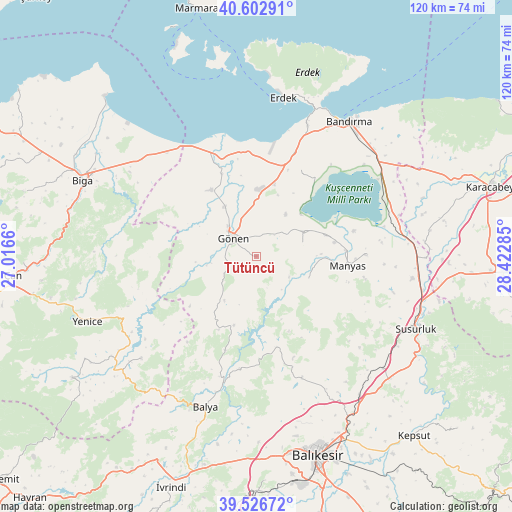
Tütüncü GPS coordinates[2]
40° 4' 0.984" North, 27° 43' 10.992" East
| Map corner | latitude | longitude |
|---|---|---|
| Upper-left | 40.60291°, | 27.0166° |
| Center: | 40.06694°, | 27.71972° |
| Lower-right: | 39.52672°, | 28.42285° |
| Map W x H: | 119.7×119.7 km | = 74.4×74.4mi |
| max Lat: | 42.02683° ⇑29.7% North |
| Tütüncü: | 40.06694° |
| min Lat: | ⇓70.3% South 35.9025° |
| min Long | Tütüncü | max Long |
| 25.90902° | 27.71972° | 44.60099° |
| W 8%⇐ | ⇒92% E |
Elevation
Elevation of Tütüncü is 87 m = 285 ft, and this is 630.4 m = 2068 ft below average elevation for this country.
| Max E: |
2682 m = 8799 ft | 82.8% |
| Avg. | 717.4 m = 2354 ft | |
| Tütüncü | 87 m = 285 ft | |
Min E: |
0 m = 0 ft | 17.2% |
See also: Turkey elevation on elevation.city.
Geographical zone
Tütüncü is located in North temperate zone (between Tropic of Cancer and the Arctic Circle). Distance of this Northern Tropic circle is 1849.1 km =1149 mi to South.| Distance of | km | miles | from Tütüncü |
|---|---|---|---|
| North Pole | 5552 | 3449.9 | to North |
| Arctic Circle | 2946.1 | 1830.6 | to North |
| Tropic Cancer | 1849.1 | 1149 | to South |
| Equator | 4455 | 2768.2 | to South |


Nearby cities:
15 places around Tütüncü: (largest is in red/bold)
• Aksakal
34.1 km =21.2 mi,  74°
74°
• Balya
37.4 km =23.2 mi,  198°
198°
• Buğdaylı
17.4 km =10.8 mi,  14°
14°
• Danişment
23.2 km =14.4 mi, 198°
• Darıca
13.3 km =8.3 mi,  112°
112°
• Edincik
32.9 km =20.4 mi,  21°
21°
• Göbel
36.6 km =22.7 mi,  98°
98°
• Gönen
7 km =4.3 mi,  307°
307°
• Ilıca
21.8 km =13.5 mi,  167°
167°
• Manyas
21.4 km =13.3 mi, 96°
• Pazarköy
36 km =22.4 mi,  228°
228°
• Sarıköy
18.8 km =11.7 mi,  326°
326°
• Sinekçi
34.9 km =21.7 mi, 310°
• Şamlı
30.3 km =18.8 mi,  159°
159°
• Şevketiye
11.2 km =7 mi, 74°
Sources, notices
• [Note1] Compared only with cities in Turkey existing in our database
• [Src1] Map data: © OpenStreetMap contributors (CC-BY-SA)
• [Src2] Other city data from geonames.org with taken over terms of usage.
• [Src3] Geographical zone / Annual Mean Temperature by Robert A. Rohde @ Wikipedia
