Ortaca geodata
Ortaca (Mardin) is a populated place; located in Turkey in Europe/Istanbul (GMT+3) time zone. With population of 2,599 people, there are 892 cities with bigger population in this country. Compared to other cities in Turkey, 75.5% of cities are located further ↑North; 86.8% of cities are located further ←West and 66% of cities have lower elevation than Ortaca. Note1


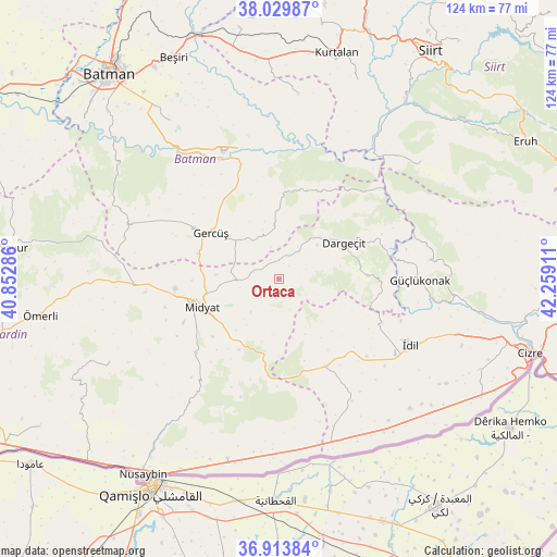
Ortaca GPS coordinates[2]
37° 28' 26.184" North, 41° 33' 21.528" East
| Map corner | latitude | longitude |
|---|---|---|
| Upper-left | 38.02987°, | 40.85286° |
| Center: | 37.47394°, | 41.55598° |
| Lower-right: | 36.91384°, | 42.25911° |
| Map W x H: | 124.1×124.1 km | = 77.1×77.1mi |
| max Lat: | 42.02683° ⇑75.5% North |
| Ortaca: | 37.47394° |
| min Lat: | ⇓24.5% South 35.9025° |
| min Long | Ortaca | max Long |
| 25.90902° | 41.55598° | 44.60099° |
| W 86.8%⇐ | ⇒13.2% E |
Elevation
Elevation of Ortaca is 976 m = 3202 ft, and this is 258.6 m = 848 ft above average elevation for this country.
| Max E: |
2682 m = 8799 ft | 34% |
| Ortaca | 976 m 3202 ft | |
| Avg. | 717.4 m = 2354 ft | |
Min E: |
0 m = 0 ft | 66% |
See also: Turkey elevation on elevation.city.
Geographical zone
Ortaca is located in North temperate zone (between Tropic of Cancer and the Arctic Circle). Distance of this Northern Tropic circle is 1560.8 km =969.8 mi to South.| Distance of | km | miles | from Ortaca |
|---|---|---|---|
| North Pole | 5840.4 | 3629.1 | to North |
| Arctic Circle | 3234.5 | 2009.8 | to North |
| Tropic Cancer | 1560.8 | 969.8 | to South |
| Equator | 4166.7 | 2589.1 | to South |


Nearby cities:
15 places around Ortaca: (largest is in red/bold)
• Barıştepe
13.6 km =8.5 mi,  274°
274°
• Başyurt
9.2 km =5.7 mi,  123°
123°
• Budaklı
21.2 km =13.2 mi,  239°
239°
• Dargeçit
16.3 km =10.1 mi,  60°
60°
• Derdil
19.9 km =12.4 mi,  343°
343°
• Dumanlı
16.7 km =10.4 mi,  134°
134°
• Gerdzhyush
18.6 km =11.6 mi,  302°
302°
• Gökçepınar
13.2 km =8.2 mi,  346°
346°
• Gülveren
5.6 km =3.5 mi,  285°
285°
• Haberli
19.5 km =12.1 mi,  163°
163°
• Kılavuz
20.1 km =12.5 mi,  88°
88°
• Midyat
20.1 km =12.5 mi,  252°
252°
• Yayvantepe
19.4 km =12.1 mi,  189°
189°
• Yolağzı
18.8 km =11.7 mi, 287°
• Çukuryurt
14.4 km =8.9 mi,  333°
333°
Sources, notices
• [Note1] Compared only with cities in Turkey existing in our database
• [Src1] Map data: © OpenStreetMap contributors (CC-BY-SA)
• [Src2] Other city data from geonames.org with taken over terms of usage.
• [Src3] Geographical zone / Annual Mean Temperature by Robert A. Rohde @ Wikipedia
