Narlıdere geodata
Narlıdere (Bitlis) is a seat of a second-order administrative division; located in Turkey in Europe/Istanbul (GMT+3) time zone. In our database, there are 1323 cities with bigger population. Compared to other cities in Turkey, 57.7% of cities are located further ↑North; 89.4% of cities are located further ←West and 61% of cities have lower elevation than Narlıdere. Note1


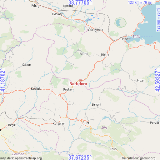
Narlıdere GPS coordinates[2]
38° 13' 36.48" North, 41° 53' 24.504" East
| Map corner | latitude | longitude |
|---|---|---|
| Upper-left | 38.77705°, | 41.18702° |
| Center: | 38.2268°, | 41.89014° |
| Lower-right: | 37.67235°, | 42.59327° |
| Map W x H: | 122.8×122.8 km | = 76.3×76.3mi |
| max Lat: | 42.02683° ⇑57.7% North |
| Narlıdere: | 38.2268° |
| min Lat: | ⇓42.3% South 35.9025° |
| min Long | Narlıdere | max Long |
| 25.90902° | 41.89014° | 44.60099° |
| W 89.4%⇐ | ⇒10.6% E |
Elevation
Elevation of Narlıdere is 897 m = 2943 ft, and this is 179.6 m = 589 ft above average elevation for this country.
| Max E: |
2682 m = 8799 ft | 39% |
| Narlıdere | 897 m 2943 ft | |
| Avg. | 717.4 m = 2354 ft | |
Min E: |
0 m = 0 ft | 61% |
See also: Turkey elevation on elevation.city.
Geographical zone
Narlıdere is located in North temperate zone (between Tropic of Cancer and the Arctic Circle). Distance of this Northern Tropic circle is 1644.5 km =1021.8 mi to South.| Distance of | km | miles | from Narlıdere |
|---|---|---|---|
| North Pole | 5756.6 | 3577 | to North |
| Arctic Circle | 3150.8 | 1957.8 | to North |
| Tropic Cancer | 1644.5 | 1021.8 | to South |
| Equator | 4250.4 | 2641.1 | to South |


Nearby cities:
15 places around Narlıdere: (largest is in red/bold)
• Aktaş
31.2 km =19.4 mi,  193°
193°
• Baykan
12.8 km =8 mi,  232°
232°
• Bitlis
27.1 km =16.8 mi,  44°
44°
• Cevizlik
29.9 km =18.6 mi,  100°
100°
• Dilektepe
17.7 km =11 mi,  198°
198°
• Doluharman
26.9 km =16.7 mi,  175°
175°
• Geyikpınar
11.8 km =7.3 mi,  328°
328°
• Kavakbaşı
29.2 km =18.1 mi,  347°
347°
• Melefan
28.6 km =17.8 mi,  259°
259°
• Meydan
17.8 km =11.1 mi,  323°
323°
• Mutki
20.1 km =12.5 mi,  7°
7°
• Sarıkonak
6.3 km =3.9 mi,  73°
73°
• Simek
27.2 km =16.9 mi, 65°
• İkizbağlar
28.5 km =17.7 mi,  165°
165°
• Şirvan
21.8 km =13.5 mi,  147°
147°
Sources, notices
• [Note1] Compared only with cities in Turkey existing in our database
• [Src1] Map data: © OpenStreetMap contributors (CC-BY-SA)
• [Src2] Other city data from geonames.org with taken over terms of usage.
• [Src3] Geographical zone / Annual Mean Temperature by Robert A. Rohde @ Wikipedia
