Muradiye geodata
Muradiye (Van) is a seat of a second-order administrative division; located in Turkey in Europe/Istanbul (GMT+3) time zone. In our database, there are 1323 cities with bigger population. Compared to other cities in Turkey, 54.2% of cities are located further ↓South; 99.2% of cities are located further ←West and 95.1% of cities have lower elevation than Muradiye. Note1


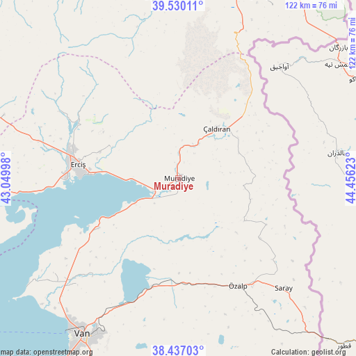
Muradiye GPS coordinates[2]
38° 59' 8.448" North, 43° 45' 11.16" East
| Map corner | latitude | longitude |
|---|---|---|
| Upper-left | 39.53011°, | 43.04998° |
| Center: | 38.98568°, | 43.7531° |
| Lower-right: | 38.43703°, | 44.45623° |
| Map W x H: | 121.5×121.5 km | = 75.5×75.5mi |
| max Lat: | 42.02683° ⇑45.8% North |
| Muradiye: | 38.98568° |
| min Lat: | ⇓54.2% South 35.9025° |
| min Long | Muradiye | max Long |
| 25.90902° | 43.7531° | 44.60099° |
| W 99.2%⇐ | ⇒0.8% E |
Elevation
Elevation of Muradiye is 1683 m = 5522 ft, and this is 965.6 m = 3168 ft above average elevation for this country.
| Max E: |
2682 m = 8799 ft | 4.9% |
| Muradiye | 1683 m 5522 ft | |
| Avg. | 717.4 m = 2354 ft | |
Min E: |
0 m = 0 ft | 95.1% |
See also: Turkey elevation on elevation.city.
Geographical zone
Muradiye is located in North temperate zone (between Tropic of Cancer and the Arctic Circle). Distance of this Northern Tropic circle is 1728.9 km =1074.3 mi to South.| Distance of | km | miles | from Muradiye |
|---|---|---|---|
| North Pole | 5672.3 | 3524.6 | to North |
| Arctic Circle | 3066.4 | 1905.4 | to North |
| Tropic Cancer | 1728.9 | 1074.3 | to South |
| Equator | 4334.8 | 2693.5 | to South |


Nearby cities:
15 places around Muradiye: (largest is in red/bold)
• Dedeli
63.8 km =39.6 mi,  289°
289°
• Deliçay
25.5 km =15.8 mi, 294°
• Diyadin
62.1 km =38.6 mi,  353°
353°
• Dorutay
34.2 km =21.3 mi,  127°
127°
• Doğubayazıt
68.6 km =42.6 mi,  24°
24°
• Erciş
34.3 km =21.3 mi,  277°
277°
• Erçek
38.4 km =23.9 mi,  194°
194°
• Göldüzü
66.3 km =41.2 mi,  253°
253°
• Kocapınar
49.6 km =30.8 mi, 284°
• Saray
51.7 km =32.1 mi,  136°
136°
• Sarısu
72 km =44.7 mi,  272°
272°
• Timar
32.7 km =20.3 mi,  237°
237°
• Van
63.3 km =39.3 mi,  210°
210°
• Çaldıran
22.2 km =13.8 mi,  37°
37°
• Özalp
42.1 km =26.2 mi,  150°
150°
Sources, notices
• [Note1] Compared only with cities in Turkey existing in our database
• [Src1] Map data: © OpenStreetMap contributors (CC-BY-SA)
• [Src2] Other city data from geonames.org with taken over terms of usage.
• [Src3] Geographical zone / Annual Mean Temperature by Robert A. Rohde @ Wikipedia
