Kayseri geodata
Kayseri is a seat of a first-order administrative division; located in Turkey in Europe/Istanbul (GMT+3) time zone. With population of 592,840 people, there are 11 cities with bigger population in this country. Compared to other cities in Turkey, 50.5% of cities are located further ↓South; 52.3% of cities are located further →East and 71.9% of cities have lower elevation than Kayseri. Note1


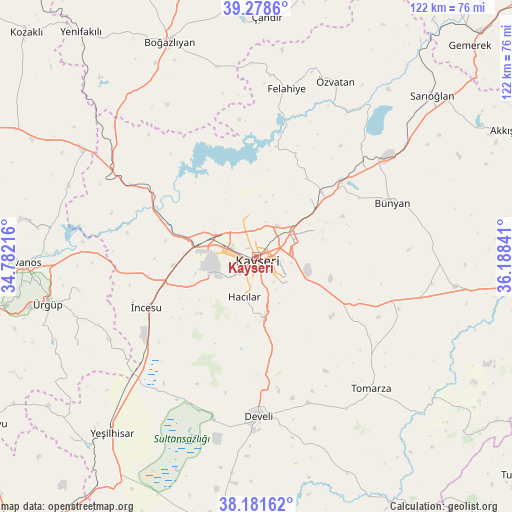
Kayseri GPS coordinates[2]
38° 43' 55.992" North, 35° 29' 7.008" East
| Map corner | latitude | longitude |
|---|---|---|
| Upper-left | 39.2786°, | 34.78216° |
| Center: | 38.73222°, | 35.48528° |
| Lower-right: | 38.18162°, | 36.18841° |
| Map W x H: | 122×122 km | = 75.8×75.8mi |
| max Lat: | 42.02683° ⇑49.5% North |
| Kayseri: | 38.73222° |
| min Lat: | ⇓50.5% South 35.9025° |
| min Long | Kayseri | max Long |
| 25.90902° | 35.48528° | 44.60099° |
| W 47.7%⇐ | ⇒52.3% E |
Elevation
Elevation of Kayseri is 1054 m = 3458 ft, and this is 336.6 m = 1104 ft above average elevation for this country.
| Max E: |
2682 m = 8799 ft | 28.1% |
| Kayseri | 1054 m 3458 ft | |
| Avg. | 717.4 m = 2354 ft | |
Min E: |
0 m = 0 ft | 71.9% |
See also: Kayseri elevation on elevation.city.
Geographical zone
Kayseri is located in North temperate zone (between Tropic of Cancer and the Arctic Circle). Distance of this Northern Tropic circle is 1700.7 km =1056.8 mi to South.| Distance of | km | miles | from Kayseri |
|---|---|---|---|
| North Pole | 5700.4 | 3542.1 | to North |
| Arctic Circle | 3094.6 | 1922.9 | to North |
| Tropic Cancer | 1700.7 | 1056.8 | to South |
| Equator | 4306.6 | 2676 | to South |


Nearby cities:
15 places around Kayseri: (largest is in red/bold)
• Bünyan
34.9 km =21.7 mi,  68°
68°
• Develi
38 km =23.6 mi,  179°
179°
• Elbaşı
42.4 km =26.3 mi,  98°
98°
• Erkilet
10.6 km =6.6 mi,  338°
338°
• Felahiye
40.5 km =25.2 mi,  10°
10°
• Gesi
16.5 km =10.3 mi, 66°
• Hacılar
10 km =6.2 mi,  198°
198°
• Himmetdede
39.1 km =24.3 mi,  300°
300°
• Kocasinan
8.7 km =5.4 mi,  60°
60°
• Melikgazi
3.6 km =2.2 mi, 302°
• Muncusun
22.6 km =14 mi,  33°
33°
• Talas
7.5 km =4.7 mi,  127°
127°
• Tomarza
41.8 km =26 mi,  139°
139°
• Özvatan
45.6 km =28.3 mi,  24°
24°
• İncesu
29 km =18 mi,  245°
245°
Sources, notices
• [Note1] Compared only with cities in Turkey existing in our database
• [Src1] Map data: © OpenStreetMap contributors (CC-BY-SA)
• [Src2] Other city data from geonames.org with taken over terms of usage.
• [Src3] Geographical zone / Annual Mean Temperature by Robert A. Rohde @ Wikipedia
