Tomarza geodata
Tomarza (Kayseri) is a seat of a second-order administrative division; located in Turkey in Europe/Istanbul (GMT+3) time zone. With population of 11,753 people, there are 459 cities with bigger population in this country. Compared to other cities in Turkey, 53.7% of cities are located further ↑North; 50.8% of cities are located further →East and 87.8% of cities have lower elevation than Tomarza. Note1


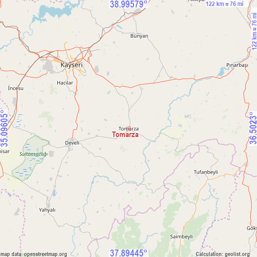
Tomarza GPS coordinates[2]
38° 26' 49.992" North, 35° 47' 57.012" East
| Map corner | latitude | longitude |
|---|---|---|
| Upper-left | 38.99579°, | 35.09605° |
| Center: | 38.44722°, | 35.79917° |
| Lower-right: | 37.89445°, | 36.5023° |
| Map W x H: | 122.5×122.5 km | = 76.1×76.1mi |
| max Lat: | 42.02683° ⇑53.7% North |
| Tomarza: | 38.44722° |
| min Lat: | ⇓46.3% South 35.9025° |
| min Long | Tomarza | max Long |
| 25.90902° | 35.79917° | 44.60099° |
| W 49.2%⇐ | ⇒50.8% E |
Elevation
Elevation of Tomarza is 1394 m = 4573 ft, and this is 676.6 m = 2220 ft above average elevation for this country.
| Max E: |
2682 m = 8799 ft | 12.2% |
| Tomarza | 1394 m 4573 ft | |
| Avg. | 717.4 m = 2354 ft | |
Min E: |
0 m = 0 ft | 87.8% |
See also: Turkey elevation on elevation.city.
Geographical zone
Tomarza is located in North temperate zone (between Tropic of Cancer and the Arctic Circle). Distance of this Northern Tropic circle is 1669 km =1037.1 mi to South.| Distance of | km | miles | from Tomarza |
|---|---|---|---|
| North Pole | 5732.1 | 3561.8 | to North |
| Arctic Circle | 3126.2 | 1942.5 | to North |
| Tropic Cancer | 1669 | 1037.1 | to South |
| Equator | 4274.9 | 2656.3 | to South |


Nearby cities:
15 places around Tomarza: (largest is in red/bold)
• Bakırdağı
25.7 km =16 mi,  181°
181°
• Bünyan
44.7 km =27.8 mi,  6°
6°
• Develi
27.5 km =17.1 mi,  256°
256°
• Elbaşı
29.1 km =18.1 mi,  30°
30°
• Erkilet
51.9 km =32.2 mi,  323°
323°
• Gesi
40.2 km =25 mi,  342°
342°
• Hacılar
37.6 km =23.4 mi,  306°
306°
• Kayseri
41.8 km =26 mi, 319°
• Kocasinan
41.1 km =25.5 mi,  331°
331°
• Melikgazi
45.3 km =28.1 mi, 317°
• Muncusun
52.8 km =32.8 mi, 343°
• Pazarören
40.2 km =25 mi,  51°
51°
• Talas
34.5 km =21.4 mi, 321°
• Toklar
19.1 km =11.9 mi,  99°
99°
• Tufanbeyli
42 km =26.1 mi,  119°
119°
Sources, notices
• [Note1] Compared only with cities in Turkey existing in our database
• [Src1] Map data: © OpenStreetMap contributors (CC-BY-SA)
• [Src2] Other city data from geonames.org with taken over terms of usage.
• [Src3] Geographical zone / Annual Mean Temperature by Robert A. Rohde @ Wikipedia
