Güneren geodata
Güneren (Şanlıurfa) is a populated place; located in Turkey in Europe/Istanbul (GMT+3) time zone. With population of 3,185 people, there are 848 cities with bigger population in this country. Compared to other cities in Turkey, 94.4% of cities are located further ↑North; 68.6% of cities are located further ←West and 67.5% of cities have higher elevation than Güneren. Note1


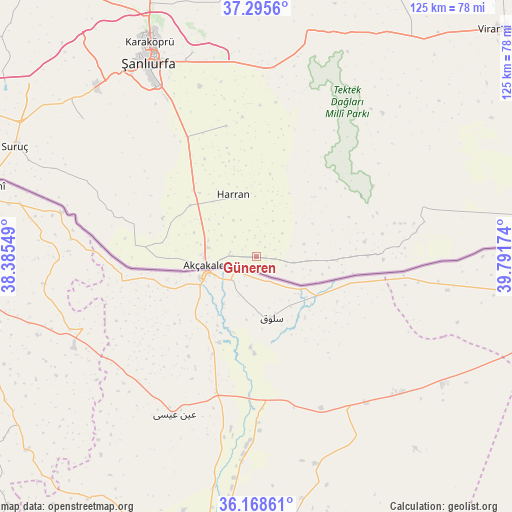
Güneren GPS coordinates[2]
36° 44' 3.012" North, 39° 5' 18.996" East
| Map corner | latitude | longitude |
|---|---|---|
| Upper-left | 37.2956°, | 38.38549° |
| Center: | 36.73417°, | 39.08861° |
| Lower-right: | 36.16861°, | 39.79174° |
| Map W x H: | 125.3×125.3 km | = 77.9×77.9mi |
| max Lat: | 42.02683° ⇑94.4% North |
| Güneren: | 36.73417° |
| min Lat: | ⇓5.6% South 35.9025° |
| min Long | Güneren | max Long |
| 25.90902° | 39.08861° | 44.60099° |
| W 68.6%⇐ | ⇒31.4% E |
Elevation
Elevation of Güneren is 364 m = 1194 ft, and this is 353.4 m = 1159 ft below average elevation for this country.
| Max E: |
2682 m = 8799 ft | 67.5% |
| Avg. | 717.4 m = 2354 ft | |
| Güneren | 364 m = 1194 ft | |
Min E: |
0 m = 0 ft | 32.5% |
See also: Turkey elevation on elevation.city.
Geographical zone
Güneren is located in North temperate zone (between Tropic of Cancer and the Arctic Circle). Distance of this Northern Tropic circle is 1478.5 km =918.7 mi to South.| Distance of | km | miles | from Güneren |
|---|---|---|---|
| North Pole | 5922.6 | 3680.1 | to North |
| Arctic Circle | 3316.7 | 2060.9 | to North |
| Tropic Cancer | 1478.5 | 918.7 | to South |
| Equator | 4084.5 | 2538 | to South |


Nearby cities:
15 places around Güneren: (largest is in red/bold)
• Akçakale
12.8 km =8 mi,  258°
258°
• Aşağı Beğdeş
17.5 km =10.9 mi,  300°
300°
• Balkat
17.2 km =10.7 mi,  330°
330°
• Bolatlar
13.2 km =8.2 mi,  286°
286°
• Ekinyazı
4.7 km =2.9 mi,  96°
96°
• Hacıekber
15.6 km =9.7 mi,  305°
305°
• Harran
14.9 km =9.3 mi,  339°
339°
• Kepezli
15.9 km =9.9 mi,  112°
112°
• Küplüce
10.6 km =6.6 mi, 325°
• Meydankapı
8.2 km =5.1 mi,  48°
48°
• Selalmaz
9.5 km =5.9 mi,  24°
24°
• Sugeldi
9.7 km =6 mi, 335°
• Tahılalan
16.9 km =10.5 mi,  322°
322°
• Uluağaç
13 km =8.1 mi, 20°
• Öncül
5.8 km =3.6 mi,  245°
245°
Sources, notices
• [Note1] Compared only with cities in Turkey existing in our database
• [Src1] Map data: © OpenStreetMap contributors (CC-BY-SA)
• [Src2] Other city data from geonames.org with taken over terms of usage.
• [Src3] Geographical zone / Annual Mean Temperature by Robert A. Rohde @ Wikipedia
