Doğanbey geodata
Doğanbey (Konya) is a seat of a third-order administrative division; located in Turkey in Europe/Istanbul (GMT+3) time zone. In our database, there are 1323 cities with bigger population. Compared to other cities in Turkey, 68.4% of cities are located further ↑North; 67.1% of cities are located further →East and 83.1% of cities have lower elevation than Doğanbey. Note1


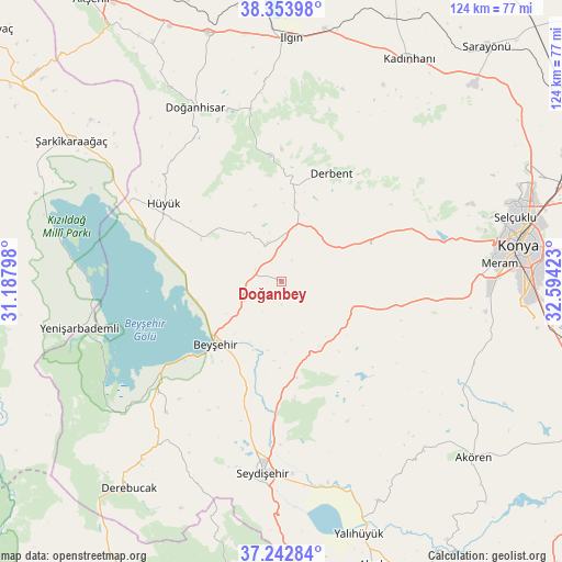
Doğanbey GPS coordinates[2]
37° 48' 1.8" North, 31° 53' 27.96" East
| Map corner | latitude | longitude |
|---|---|---|
| Upper-left | 38.35398°, | 31.18798° |
| Center: | 37.8005°, | 31.8911° |
| Lower-right: | 37.24284°, | 32.59423° |
| Map W x H: | 123.5×123.5 km | = 76.7×76.7mi |
| max Lat: | 42.02683° ⇑68.4% North |
| Doğanbey: | 37.8005° |
| min Lat: | ⇓31.6% South 35.9025° |
| min Long | Doğanbey | max Long |
| 25.90902° | 31.8911° | 44.60099° |
| W 32.9%⇐ | ⇒67.1% E |
Elevation
Elevation of Doğanbey is 1266 m = 4154 ft, and this is 548.6 m = 1800 ft above average elevation for this country.
| Max E: |
2682 m = 8799 ft | 16.9% |
| Doğanbey | 1266 m 4154 ft | |
| Avg. | 717.4 m = 2354 ft | |
Min E: |
0 m = 0 ft | 83.1% |
See also: Turkey elevation on elevation.city.
Geographical zone
Doğanbey is located in North temperate zone (between Tropic of Cancer and the Arctic Circle). Distance of this Northern Tropic circle is 1597.1 km =992.4 mi to South.| Distance of | km | miles | from Doğanbey |
|---|---|---|---|
| North Pole | 5804 | 3606.4 | to North |
| Arctic Circle | 3198.2 | 1987.3 | to North |
| Tropic Cancer | 1597.1 | 992.4 | to South |
| Equator | 4203 | 2611.6 | to South |


Nearby cities:
15 places around Doğanbey: (largest is in red/bold)
• Aşağıçiğil
28 km =17.4 mi,  355°
355°
• Beyşehir
20 km =12.4 mi,  226°
226°
• Derbent
26.2 km =16.3 mi,  24°
24°
• Doğanhisar
42.8 km =26.6 mi,  333°
333°
• Gencek
49.4 km =30.7 mi,  217°
217°
• Hatip
47 km =29.2 mi,  96°
96°
• Hatunsaray
46.7 km =29 mi,  120°
120°
• Hüyük
31 km =19.3 mi,  303°
303°
• Kızılören
21.2 km =13.2 mi,  69°
69°
• Meram
50.8 km =31.6 mi,  86°
86°
• Seydişehir
42.6 km =26.5 mi,  185°
185°
• Sille
48.5 km =30.1 mi, 73°
• Yenişarbademli
45.6 km =28.3 mi,  256°
256°
• Çavuş
21.5 km =13.4 mi,  170°
170°
• Üzümlü
38.4 km =23.9 mi, 221°
Sources, notices
• [Note1] Compared only with cities in Turkey existing in our database
• [Src1] Map data: © OpenStreetMap contributors (CC-BY-SA)
• [Src2] Other city data from geonames.org with taken over terms of usage.
• [Src3] Geographical zone / Annual Mean Temperature by Robert A. Rohde @ Wikipedia
