Büyükkaracaören geodata
Büyükkaracaören (Gaziantep) is a populated place; located in Turkey in Europe/Istanbul (GMT+3) time zone. With population of 576 people, there are 1267 cities with bigger population in this country. Compared to other cities in Turkey, 93.9% of cities are located further ↑North; 59.1% of cities are located further ←West and 55.3% of cities have higher elevation than Büyükkaracaören. Note1


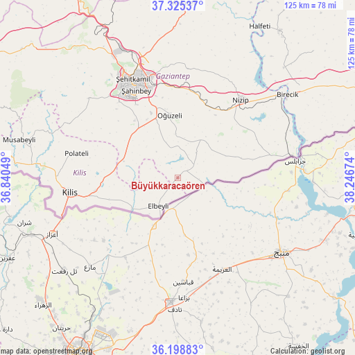
Büyükkaracaören GPS coordinates[2]
36° 45' 51.012" North, 37° 32' 36.996" East
| Map corner | latitude | longitude |
|---|---|---|
| Upper-left | 37.32537°, | 36.84049° |
| Center: | 36.76417°, | 37.54361° |
| Lower-right: | 36.19883°, | 38.24674° |
| Map W x H: | 125.3×125.3 km | = 77.9×77.9mi |
| max Lat: | 42.02683° ⇑93.9% North |
| Büyükkaracaören: | 36.76417° |
| min Lat: | ⇓6.1% South 35.9025° |
| min Long | Büyükkaracaö | max Long |
| 25.90902° | 37.54361° | 44.60099° |
| W 59.1%⇐ | ⇒40.9% E |
Elevation
Elevation of Büyükkaracaören is 581 m = 1906 ft, and this is 136.4 m = 448 ft below average elevation for this country.
| Max E: |
2682 m = 8799 ft | 55.3% |
| Avg. | 717.4 m = 2354 ft | |
| Büyükkaracaören | 581 m = 1906 ft | |
Min E: |
0 m = 0 ft | 44.7% |
See also: Turkey elevation on elevation.city.
Geographical zone
Büyükkaracaören is located in North temperate zone (between Tropic of Cancer and the Arctic Circle). Distance of this Northern Tropic circle is 1481.9 km =920.8 mi to South.| Distance of | km | miles | from Büyükkaracaören |
|---|---|---|---|
| North Pole | 5919.3 | 3678.1 | to North |
| Arctic Circle | 3313.4 | 2058.9 | to North |
| Tropic Cancer | 1481.9 | 920.8 | to South |
| Equator | 4087.8 | 2540 | to South |


Nearby cities:
15 places around Büyükkaracaören: (largest is in red/bold)
• Aşağıbeylerbeyi
7.9 km =4.9 mi,  194°
194°
• Doğanpınar
11 km =6.8 mi,  36°
36°
• Elbeyli
12.1 km =7.5 mi,  214°
214°
• Gevence
31.5 km =19.6 mi,  58°
58°
• Gündoğan
12.5 km =7.8 mi,  1°
1°
• Kirap
19.2 km =11.9 mi,  47°
47°
• Oğuzeli
22.6 km =14 mi,  353°
353°
• Sekili
26.4 km =16.4 mi,  25°
25°
• Uluyatır
25.9 km =16.1 mi, 31°
• Yakacık
14.6 km =9.1 mi,  359°
359°
• Yeserti
28.7 km =17.8 mi,  70°
70°
• Yeşildere
23.6 km =14.7 mi, 349°
• Zeytinli
23.5 km =14.6 mi,  332°
332°
• Çiflikköy
23.6 km =14.7 mi, 72°
• İkizce
23.3 km =14.5 mi, 61°
Sources, notices
• [Note1] Compared only with cities in Turkey existing in our database
• [Src1] Map data: © OpenStreetMap contributors (CC-BY-SA)
• [Src2] Other city data from geonames.org with taken over terms of usage.
• [Src3] Geographical zone / Annual Mean Temperature by Robert A. Rohde @ Wikipedia
