Uluyatır geodata
Uluyatır (Gaziantep) is a populated place; located in Turkey in Europe/Istanbul (GMT+3) time zone. With population of 3,350 people, there are 833 cities with bigger population in this country. Compared to other cities in Turkey, 88.9% of cities are located further ↑North; 59.8% of cities are located further ←West and 56.1% of cities have higher elevation than Uluyatır. Note1


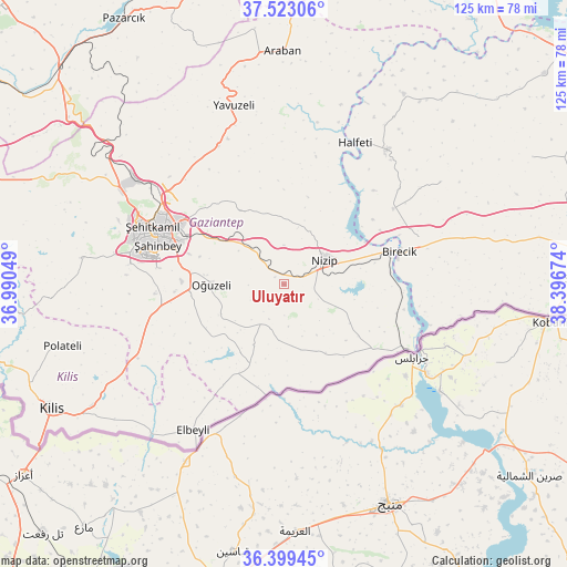
Uluyatır GPS coordinates[2]
36° 57' 47.988" North, 37° 41' 36.996" East
| Map corner | latitude | longitude |
|---|---|---|
| Upper-left | 37.52306°, | 36.99049° |
| Center: | 36.96333°, | 37.69361° |
| Lower-right: | 36.39945°, | 38.39674° |
| Map W x H: | 124.9×124.9 km | = 77.6×77.6mi |
| max Lat: | 42.02683° ⇑88.9% North |
| Uluyatır: | 36.96333° |
| min Lat: | ⇓11.1% South 35.9025° |
| min Long | Uluyatır | max Long |
| 25.90902° | 37.69361° | 44.60099° |
| W 59.8%⇐ | ⇒40.2% E |
Elevation
Elevation of Uluyatır is 568 m = 1864 ft, and this is 149.4 m = 490 ft below average elevation for this country.
| Max E: |
2682 m = 8799 ft | 56.1% |
| Avg. | 717.4 m = 2354 ft | |
| Uluyatır | 568 m = 1864 ft | |
Min E: |
0 m = 0 ft | 43.9% |
See also: Turkey elevation on elevation.city.
Geographical zone
Uluyatır is located in North temperate zone (between Tropic of Cancer and the Arctic Circle). Distance of this Northern Tropic circle is 1504 km =934.5 mi to South.| Distance of | km | miles | from Uluyatır |
|---|---|---|---|
| North Pole | 5897.1 | 3664.3 | to North |
| Arctic Circle | 3291.2 | 2045.1 | to North |
| Tropic Cancer | 1504 | 934.5 | to South |
| Equator | 4109.9 | 2553.8 | to South |


Nearby cities:
15 places around Uluyatır: (largest is in red/bold)
• Birecik
26.2 km =16.3 mi,  74°
74°
• Büyükkaracaören
25.9 km =16.1 mi,  211°
211°
• Doğanpınar
15 km =9.3 mi, 206°
• Gevence
14.6 km =9.1 mi,  112°
112°
• Gündoğan
16.2 km =10.1 mi,  233°
233°
• Kirap
9.3 km =5.8 mi,  174°
174°
• Nizip
10.3 km =6.4 mi,  59°
59°
• Oğuzeli
16 km =9.9 mi,  270°
270°
• Sekili
2.6 km =1.6 mi,  311°
311°
• Yakacık
15.4 km =9.6 mi,  240°
240°
• Yeserti
18.4 km =11.4 mi,  132°
132°
• Yeşildere
17.7 km =11 mi, 273°
• Zeytinli
24.1 km =15 mi, 266°
• Çiflikköy
17.7 km =11 mi,  148°
148°
• İkizce
13.3 km =8.3 mi, 147°
Sources, notices
• [Note1] Compared only with cities in Turkey existing in our database
• [Src1] Map data: © OpenStreetMap contributors (CC-BY-SA)
• [Src2] Other city data from geonames.org with taken over terms of usage.
• [Src3] Geographical zone / Annual Mean Temperature by Robert A. Rohde @ Wikipedia
