Bigadiç geodata
Bigadiç (Balıkesir) is a seat of a second-order administrative division; located in Turkey in Europe/Istanbul (GMT+3) time zone. With population of 15,242 people, there are 388 cities with bigger population in this country. Compared to other cities in Turkey, 59.9% of cities are located further ↓South; 89.3% of cities are located further →East and 75.8% of cities have higher elevation than Bigadiç. Note1


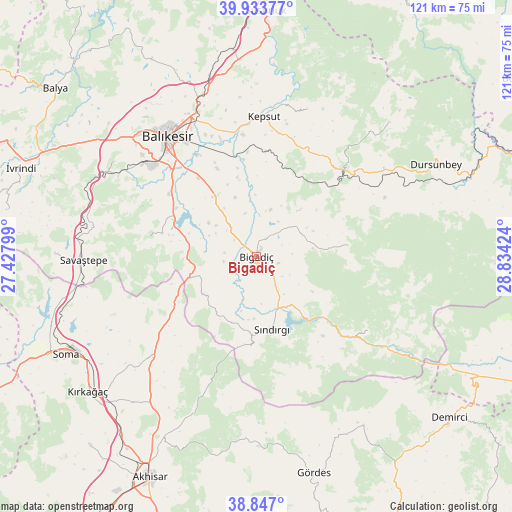
Bigadiç GPS coordinates[2]
39° 23' 33" North, 28° 7' 51.996" East
| Map corner | latitude | longitude |
|---|---|---|
| Upper-left | 39.93377°, | 27.42799° |
| Center: | 39.3925°, | 28.13111° |
| Lower-right: | 38.847°, | 28.83424° |
| Map W x H: | 120.8×120.8 km | = 75.1×75.1mi |
| max Lat: | 42.02683° ⇑40.1% North |
| Bigadiç: | 39.3925° |
| min Lat: | ⇓59.9% South 35.9025° |
| min Long | Bigadiç | max Long |
| 25.90902° | 28.13111° | 44.60099° |
| W 10.7%⇐ | ⇒89.3% E |
Elevation
Elevation of Bigadiç is 165 m = 541 ft, and this is 552.4 m = 1812 ft below average elevation for this country.
| Max E: |
2682 m = 8799 ft | 75.8% |
| Avg. | 717.4 m = 2354 ft | |
| Bigadiç | 165 m = 541 ft | |
Min E: |
0 m = 0 ft | 24.2% |
See also: Turkey elevation on elevation.city.
Geographical zone
Bigadiç is located in North temperate zone (between Tropic of Cancer and the Arctic Circle). Distance of this Northern Tropic circle is 1774.1 km =1102.4 mi to South.| Distance of | km | miles | from Bigadiç |
|---|---|---|---|
| North Pole | 5627 | 3496.5 | to North |
| Arctic Circle | 3021.1 | 1877.2 | to North |
| Tropic Cancer | 1774.1 | 1102.4 | to South |
| Equator | 4380 | 2721.6 | to South |


Nearby cities:
15 places around Bigadiç: (largest is in red/bold)
• Balıkesir
35.4 km =22 mi,  323°
323°
• Durak
36.9 km =22.9 mi,  19°
19°
• Düvertepe
31.7 km =19.7 mi,  122°
122°
• Ertuğrul
41.7 km =25.9 mi,  299°
299°
• Gelembe
34 km =21.1 mi,  225°
225°
• Gölcük
15.5 km =9.6 mi,  235°
235°
• Kavacık
44.3 km =27.5 mi,  44°
44°
• Kepsut
33 km =20.5 mi,  3°
3°
• Kireç
27 km =16.8 mi,  47°
47°
• Konakpınar
25.7 km =16 mi,  280°
280°
• Savaştepe
40.8 km =25.4 mi,  268°
268°
• Sındırgı
17.3 km =10.7 mi,  166°
166°
• Yağcılar
21.7 km =13.5 mi,  82°
82°
• Yeniköy
44.3 km =27.5 mi,  345°
345°
• Çağış
17.4 km =10.8 mi, 323°
Sources, notices
• [Note1] Compared only with cities in Turkey existing in our database
• [Src1] Map data: © OpenStreetMap contributors (CC-BY-SA)
• [Src2] Other city data from geonames.org with taken over terms of usage.
• [Src3] Geographical zone / Annual Mean Temperature by Robert A. Rohde @ Wikipedia
