Beyçayırı geodata
Beyçayırı (Batman) is a seat of a third-order administrative division; located in Turkey in Europe/Istanbul (GMT+3) time zone. In our database, there are 1323 cities with bigger population. Compared to other cities in Turkey, 61.3% of cities are located further ↑North; 84.6% of cities are located further ←West and 53.3% of cities have higher elevation than Beyçayırı. Note1


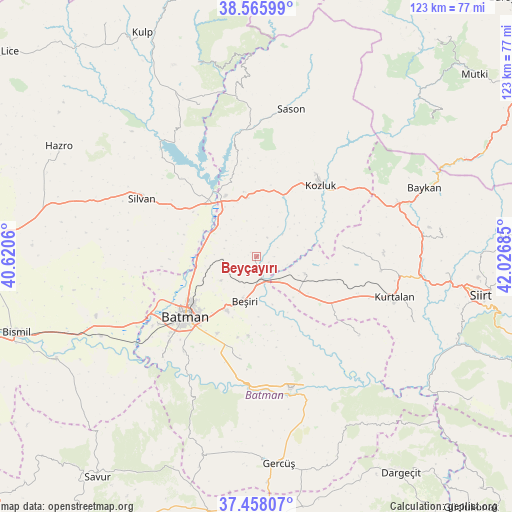
Beyçayırı GPS coordinates[2]
38° 0' 50.832" North, 41° 19' 25.392" East
| Map corner | latitude | longitude |
|---|---|---|
| Upper-left | 38.56599°, | 40.6206° |
| Center: | 38.01412°, | 41.32372° |
| Lower-right: | 37.45807°, | 42.02685° |
| Map W x H: | 123.2×123.2 km | = 76.6×76.6mi |
| max Lat: | 42.02683° ⇑61.3% North |
| Beyçayırı: | 38.01412° |
| min Lat: | ⇓38.7% South 35.9025° |
| min Long | Beyçayırı | max Long |
| 25.90902° | 41.32372° | 44.60099° |
| W 84.6%⇐ | ⇒15.4% E |
Elevation
Elevation of Beyçayırı is 627 m = 2057 ft, and this is 90.4 m = 297 ft below average elevation for this country.
| Max E: |
2682 m = 8799 ft | 53.3% |
| Avg. | 717.4 m = 2354 ft | |
| Beyçayırı | 627 m = 2057 ft | |
Min E: |
0 m = 0 ft | 46.7% |
See also: Turkey elevation on elevation.city.
Geographical zone
Beyçayırı is located in North temperate zone (between Tropic of Cancer and the Arctic Circle). Distance of this Northern Tropic circle is 1620.9 km =1007.2 mi to South.| Distance of | km | miles | from Beyçayırı |
|---|---|---|---|
| North Pole | 5780.3 | 3591.7 | to North |
| Arctic Circle | 3174.4 | 1972.5 | to North |
| Tropic Cancer | 1620.9 | 1007.2 | to South |
| Equator | 4226.8 | 2626.4 | to South |


Nearby cities:
15 places around Beyçayırı: (largest is in red/bold)
• Asmadere
12.2 km =7.6 mi,  161°
161°
• Aviski
5.5 km =3.4 mi,  173°
173°
• Bekirhan
14.3 km =8.9 mi,  349°
349°
• Beşiri
11.4 km =7.1 mi,  196°
196°
• Danalı
15.8 km =9.8 mi, 201°
• Demirlipınar
14.2 km =8.8 mi,  245°
245°
• Demiryol
18.6 km =11.6 mi,  234°
234°
• Doğankavak
10.2 km =6.3 mi,  236°
236°
• Gökdoğan
9.8 km =6.1 mi,  133°
133°
• Gözpınar
12.4 km =7.7 mi,  109°
109°
• Kösetarla
17.7 km =11 mi,  218°
218°
• Malabadi
18.6 km =11.6 mi,  325°
325°
• Saipbeyli
16.5 km =10.3 mi,  96°
96°
• Taliban
8.7 km =5.4 mi,  115°
115°
• Yontukyazı
14.5 km =9 mi,  178°
178°
Sources, notices
• [Note1] Compared only with cities in Turkey existing in our database
• [Src1] Map data: © OpenStreetMap contributors (CC-BY-SA)
• [Src2] Other city data from geonames.org with taken over terms of usage.
• [Src3] Geographical zone / Annual Mean Temperature by Robert A. Rohde @ Wikipedia
