Bayındır geodata
Bayındır (İzmir) is a populated place; located in Turkey in Europe/Istanbul (GMT+3) time zone. With population of 16,850 people, there are 368 cities with bigger population in this country. Compared to other cities in Turkey, 57.8% of cities are located further ↑North; 92.7% of cities are located further →East and 84.9% of cities have higher elevation than Bayındır. Note1


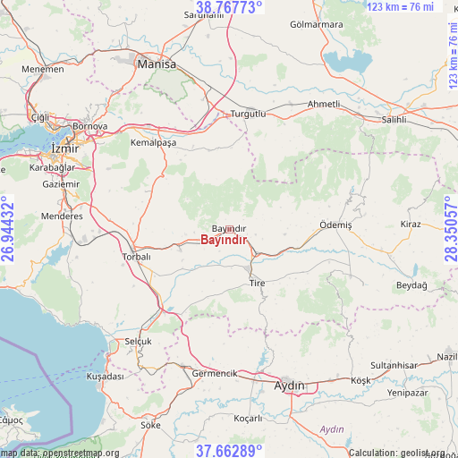
Bayındır GPS coordinates[2]
38° 13' 2.676" North, 27° 38' 50.784" East
| Map corner | latitude | longitude |
|---|---|---|
| Upper-left | 38.76773°, | 26.94432° |
| Center: | 38.21741°, | 27.64744° |
| Lower-right: | 37.66289°, | 28.35057° |
| Map W x H: | 122.8×122.8 km | = 76.3×76.3mi |
| max Lat: | 42.02683° ⇑57.8% North |
| Bayındır: | 38.21741° |
| min Lat: | ⇓42.2% South 35.9025° |
| min Long | Bayındır | max Long |
| 25.90902° | 27.64744° | 44.60099° |
| W 7.3%⇐ | ⇒92.7% E |
Elevation
Elevation of Bayındır is 72 m = 236 ft, and this is 645.4 m = 2117 ft below average elevation for this country.
| Max E: |
2682 m = 8799 ft | 84.9% |
| Avg. | 717.4 m = 2354 ft | |
| Bayındır | 72 m = 236 ft | |
Min E: |
0 m = 0 ft | 15.1% |
See also: Turkey elevation on elevation.city.
Geographical zone
Bayındır is located in North temperate zone (between Tropic of Cancer and the Arctic Circle). Distance of this Northern Tropic circle is 1643.5 km =1021.2 mi to South.| Distance of | km | miles | from Bayındır |
|---|---|---|---|
| North Pole | 5757.7 | 3577.7 | to North |
| Arctic Circle | 3151.8 | 1958.4 | to North |
| Tropic Cancer | 1643.5 | 1021.2 | to South |
| Equator | 4249.4 | 2640.5 | to South |


Nearby cities:
15 places around Bayındır: (largest is in red/bold)
• Belevi
28.4 km =17.6 mi,  217°
217°
• Birgi
36.1 km =22.4 mi,  84°
84°
• Boğaziçi
21.7 km =13.5 mi,  200°
200°
• Dağkızılca
24.7 km =15.3 mi,  294°
294°
• Gökçen
22.7 km =14.1 mi,  120°
120°
• Karaoğlanlı
35.4 km =22 mi,  348°
348°
• Kemalpaşa
30.7 km =19.1 mi,  319°
319°
• Konaklı
32.6 km =20.3 mi,  110°
110°
• Ovakent
34.9 km =21.7 mi, 110°
• Selçuk
38.4 km =23.9 mi, 219°
• Tire
16.2 km =10.1 mi,  151°
151°
• Torbalı
26 km =16.2 mi,  253°
253°
• Turgutlu
31.2 km =19.4 mi,  8°
8°
• Çırpı
14.4 km =8.9 mi, 245°
• Ödemiş
28.2 km =17.5 mi,  87°
87°
Sources, notices
• [Note1] Compared only with cities in Turkey existing in our database
• [Src1] Map data: © OpenStreetMap contributors (CC-BY-SA)
• [Src2] Other city data from geonames.org with taken over terms of usage.
• [Src3] Geographical zone / Annual Mean Temperature by Robert A. Rohde @ Wikipedia
