Karaoğlanlı geodata
Karaoğlanlı (Manisa) is a seat of a third-order administrative division; located in Turkey in Europe/Istanbul (GMT+3) time zone. In our database, there are 1323 cities with bigger population. Compared to other cities in Turkey, 52.5% of cities are located further ↑North; 93.2% of cities are located further →East and 75.6% of cities have higher elevation than Karaoğlanlı. Note1


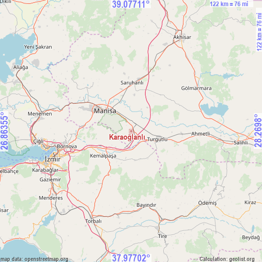
Karaoğlanlı GPS coordinates[2]
38° 31' 45.012" North, 27° 34' 0.012" East
| Map corner | latitude | longitude |
|---|---|---|
| Upper-left | 39.07711°, | 26.86355° |
| Center: | 38.52917°, | 27.56667° |
| Lower-right: | 37.97702°, | 28.2698° |
| Map W x H: | 122.3×122.3 km | = 76×76mi |
| max Lat: | 42.02683° ⇑52.5% North |
| Karaoğlanlı: | 38.52917° |
| min Lat: | ⇓47.5% South 35.9025° |
| min Long | Karaoğlanlı | max Long |
| 25.90902° | 27.56667° | 44.60099° |
| W 6.8%⇐ | ⇒93.2% E |
Elevation
Elevation of Karaoğlanlı is 167 m = 548 ft, and this is 550.4 m = 1806 ft below average elevation for this country.
| Max E: |
2682 m = 8799 ft | 75.6% |
| Avg. | 717.4 m = 2354 ft | |
| Karaoğlanlı | 167 m = 548 ft | |
Min E: |
0 m = 0 ft | 24.4% |
See also: Turkey elevation on elevation.city.
Geographical zone
Karaoğlanlı is located in North temperate zone (between Tropic of Cancer and the Arctic Circle). Distance of this Northern Tropic circle is 1678.1 km =1042.7 mi to South.| Distance of | km | miles | from Karaoğlanlı |
|---|---|---|---|
| North Pole | 5723 | 3556.1 | to North |
| Arctic Circle | 3117.1 | 1936.9 | to North |
| Tropic Cancer | 1678.1 | 1042.7 | to South |
| Equator | 4284 | 2662 | to South |


Nearby cities:
15 places around Karaoğlanlı: (largest is in red/bold)
• Ahmetli
32.4 km =20.1 mi,  91°
91°
• Bayraklı
35.7 km =22.2 mi,  258°
258°
• Bayındır
35.4 km =22 mi,  168°
168°
• Bornova
29 km =18 mi, 258°
• Buca
37.7 km =23.4 mi,  247°
247°
• Dağkızılca
28.7 km =17.8 mi,  212°
212°
• Gölmarmara
36.5 km =22.7 mi,  55°
55°
• Halitpaşa
19.9 km =12.4 mi,  29°
29°
• Kemalpaşa
17.3 km =10.7 mi,  228°
228°
• Manisa
15.3 km =9.5 mi,  307°
307°
• Muradiye
24.6 km =15.3 mi, 306°
• Osmancalı
37.6 km =23.4 mi, 313°
• Saruhanlı
22.8 km =14.2 mi,  0°
0°
• Turgutlu
12.2 km =7.6 mi,  108°
108°
• Üçpınar
28.9 km =18 mi,  322°
322°
Sources, notices
• [Note1] Compared only with cities in Turkey existing in our database
• [Src1] Map data: © OpenStreetMap contributors (CC-BY-SA)
• [Src2] Other city data from geonames.org with taken over terms of usage.
• [Src3] Geographical zone / Annual Mean Temperature by Robert A. Rohde @ Wikipedia
