Yoğun geodata
Yoğun (Diyarbakır) is a seat of a third-order administrative division; located in Turkey in Europe/Istanbul (GMT+3) time zone. In our database, there are 1323 cities with bigger population. Compared to other cities in Turkey, 59.9% of cities are located further ↑North; 71.2% of cities are located further ←West and 67.1% of cities have lower elevation than Yoğun. Note1


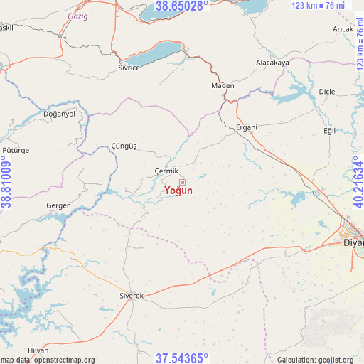
Yoğun GPS coordinates[2]
38° 5' 56.616" North, 39° 30' 47.556" East
| Map corner | latitude | longitude |
|---|---|---|
| Upper-left | 38.65028°, | 38.81009° |
| Center: | 38.09906°, | 39.51321° |
| Lower-right: | 37.54365°, | 40.21634° |
| Map W x H: | 123×123 km | = 76.4×76.4mi |
| max Lat: | 42.02683° ⇑59.9% North |
| Yoğun: | 38.09906° |
| min Lat: | ⇓40.1% South 35.9025° |
| min Long | Yoğun | max Long |
| 25.90902° | 39.51321° | 44.60099° |
| W 71.2%⇐ | ⇒28.8% E |
Elevation
Elevation of Yoğun is 988 m = 3241 ft, and this is 270.6 m = 888 ft above average elevation for this country.
| Max E: |
2682 m = 8799 ft | 32.9% |
| Yoğun | 988 m 3241 ft | |
| Avg. | 717.4 m = 2354 ft | |
Min E: |
0 m = 0 ft | 67.1% |
See also: Turkey elevation on elevation.city.
Geographical zone
Yoğun is located in North temperate zone (between Tropic of Cancer and the Arctic Circle). Distance of this Northern Tropic circle is 1630.3 km =1013 mi to South.| Distance of | km | miles | from Yoğun |
|---|---|---|---|
| North Pole | 5770.8 | 3585.8 | to North |
| Arctic Circle | 3165 | 1966.6 | to North |
| Tropic Cancer | 1630.3 | 1013 | to South |
| Equator | 4236.2 | 2632.3 | to South |


Nearby cities:
15 places around Yoğun: (largest is in red/bold)
• Ahmetli
31.3 km =19.4 mi,  73°
73°
• Bucak
47.1 km =29.3 mi,  237°
237°
• Ergani
28.3 km =17.6 mi,  48°
48°
• Gerger
42.7 km =26.5 mi,  259°
259°
• Gerger
46.5 km =28.9 mi,  249°
249°
• Hazar
33 km =20.5 mi,  346°
346°
• Karacadağ
42.5 km =26.4 mi,  165°
165°
• Karahan
27.3 km =17 mi,  215°
215°
• Maden
34.6 km =21.5 mi,  22°
22°
• Siverek
42 km =26.1 mi,  204°
204°
• Sivrice
42.1 km =26.2 mi,  334°
334°
• Taraksu
32.5 km =20.2 mi,  280°
280°
• Taraksu
38.7 km =24 mi, 256°
• Çermik
7.2 km =4.5 mi,  304°
304°
• Çüngüş
23.3 km =14.5 mi, 301°
Sources, notices
• [Note1] Compared only with cities in Turkey existing in our database
• [Src1] Map data: © OpenStreetMap contributors (CC-BY-SA)
• [Src2] Other city data from geonames.org with taken over terms of usage.
• [Src3] Geographical zone / Annual Mean Temperature by Robert A. Rohde @ Wikipedia
