Altınyayla geodata
Altınyayla (Burdur) is a seat of a second-order administrative division; located in Turkey in Europe/Istanbul (GMT+3) time zone. With population of 4,158 people, there are 767 cities with bigger population in this country. Compared to other cities in Turkey, 87.9% of cities are located further ↑North; 79% of cities are located further →East and 82.1% of cities have lower elevation than Altınyayla. Note1


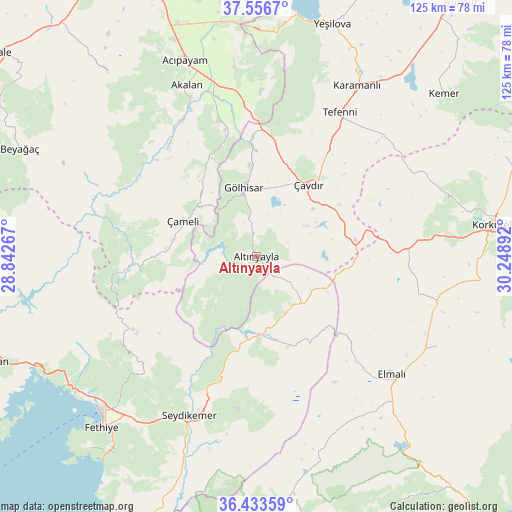
Altınyayla GPS coordinates[2]
36° 59' 49.992" North, 29° 32' 44.844" East
| Map corner | latitude | longitude |
|---|---|---|
| Upper-left | 37.5567°, | 28.84267° |
| Center: | 36.99722°, | 29.54579° |
| Lower-right: | 36.43359°, | 30.24892° |
| Map W x H: | 124.9×124.9 km | = 77.6×77.6mi |
| max Lat: | 42.02683° ⇑87.9% North |
| Altınyayla: | 36.99722° |
| min Lat: | ⇓12.1% South 35.9025° |
| min Long | Altınyayla | max Long |
| 25.90902° | 29.54579° | 44.60099° |
| W 21%⇐ | ⇒79% E |
Elevation
Elevation of Altınyayla is 1239 m = 4065 ft, and this is 521.6 m = 1711 ft above average elevation for this country.
| Max E: |
2682 m = 8799 ft | 17.9% |
| Altınyayla | 1239 m 4065 ft | |
| Avg. | 717.4 m = 2354 ft | |
Min E: |
0 m = 0 ft | 82.1% |
See also: Turkey elevation on elevation.city.
Geographical zone
Altınyayla is located in North temperate zone (between Tropic of Cancer and the Arctic Circle). Distance of this Northern Tropic circle is 1507.8 km =936.9 mi to South.| Distance of | km | miles | from Altınyayla |
|---|---|---|---|
| North Pole | 5893.4 | 3662 | to North |
| Arctic Circle | 3287.5 | 2042.8 | to North |
| Tropic Cancer | 1507.8 | 936.9 | to South |
| Equator | 4113.7 | 2556.1 | to South |


Nearby cities:
15 places around Altınyayla: (largest is in red/bold)
• Acıpayam
50.5 km =31.4 mi,  339°
339°
• Akçay
47.4 km =29.5 mi,  157°
157°
• Elmalı
44 km =27.3 mi,  131°
131°
• Gölhisar
16.9 km =10.5 mi,  348°
348°
• Gölova
49.1 km =30.5 mi,  116°
116°
• Karamanlı
48.5 km =30.1 mi,  30°
30°
• Kelekçi
34.5 km =21.4 mi,  321°
321°
• Kemer
42.2 km =26.2 mi,  203°
203°
• Kızılcadağ
37.1 km =23.1 mi,  86°
86°
• Kızılyaka
2.2 km =1.4 mi,  224°
224°
• Seki
23.5 km =14.6 mi, 156°
• Tefenni
40.3 km =25 mi, 30°
• Yeşilüzümlü
40.4 km =25.1 mi, 223°
• Çameli
19.9 km =12.4 mi,  296°
296°
• Çavdır
21.9 km =13.6 mi,  36°
36°
Sources, notices
• [Note1] Compared only with cities in Turkey existing in our database
• [Src1] Map data: © OpenStreetMap contributors (CC-BY-SA)
• [Src2] Other city data from geonames.org with taken over terms of usage.
• [Src3] Geographical zone / Annual Mean Temperature by Robert A. Rohde @ Wikipedia
