Çameli geodata
Çameli (Denizli) is a seat of a second-order administrative division; located in Turkey in Europe/Istanbul (GMT+3) time zone. In our database, there are 1323 cities with bigger population. Compared to other cities in Turkey, 86.7% of cities are located further ↑North; 80.9% of cities are located further →East and 85% of cities have lower elevation than Çameli. Note1


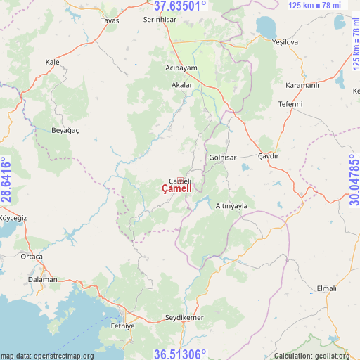
Çameli GPS coordinates[2]
37° 4' 33.996" North, 29° 20' 40.992" East
| Map corner | latitude | longitude |
|---|---|---|
| Upper-left | 37.63501°, | 28.6416° |
| Center: | 37.07611°, | 29.34472° |
| Lower-right: | 36.51306°, | 30.04785° |
| Map W x H: | 124.7×124.7 km | = 77.5×77.5mi |
| max Lat: | 42.02683° ⇑86.7% North |
| Çameli: | 37.07611° |
| min Lat: | ⇓13.3% South 35.9025° |
| min Long | Çameli | max Long |
| 25.90902° | 29.34472° | 44.60099° |
| W 19.1%⇐ | ⇒80.9% E |
Elevation
Elevation of Çameli is 1311 m = 4301 ft, and this is 593.6 m = 1948 ft above average elevation for this country.
| Max E: |
2682 m = 8799 ft | 15% |
| Çameli | 1311 m 4301 ft | |
| Avg. | 717.4 m = 2354 ft | |
Min E: |
0 m = 0 ft | 85% |
See also: Turkey elevation on elevation.city.
Geographical zone
Çameli is located in North temperate zone (between Tropic of Cancer and the Arctic Circle). Distance of this Northern Tropic circle is 1516.6 km =942.4 mi to South.| Distance of | km | miles | from Çameli |
|---|---|---|---|
| North Pole | 5884.6 | 3656.5 | to North |
| Arctic Circle | 3278.7 | 2037.3 | to North |
| Tropic Cancer | 1516.6 | 942.4 | to South |
| Equator | 4122.5 | 2561.6 | to South |


Nearby cities:
15 places around Çameli: (largest is in red/bold)
• Acıpayam
38.7 km =24 mi,  0°
0°
• Altınyayla
19.9 km =12.4 mi,  116°
116°
• Beyağaç
43.5 km =27 mi,  293°
293°
• Göcek
50.5 km =31.4 mi,  224°
224°
• Gölhisar
16.5 km =10.3 mi,  61°
61°
• Kargı
48.1 km =29.9 mi,  209°
209°
• Kelekçi
18.7 km =11.6 mi,  348°
348°
• Kemer
47.6 km =29.6 mi,  178°
178°
• Kızılyaka
19.3 km =12 mi, 122°
• Nikfer
41 km =25.5 mi,  333°
333°
• Seki
40.7 km =25.3 mi,  137°
137°
• Tefenni
46.1 km =28.6 mi, 55°
• Yaniklar
48.5 km =30.1 mi, 212°
• Yeşilüzümlü
39.3 km =24.4 mi,  194°
194°
• Çavdır
32.2 km =20 mi,  74°
74°
Sources, notices
• [Note1] Compared only with cities in Turkey existing in our database
• [Src1] Map data: © OpenStreetMap contributors (CC-BY-SA)
• [Src2] Other city data from geonames.org with taken over terms of usage.
• [Src3] Geographical zone / Annual Mean Temperature by Robert A. Rohde @ Wikipedia
