Yeşilüzümlü geodata
Yeşilüzümlü (Muğla) is a seat of a third-order administrative division; located in Turkey in Europe/Istanbul (GMT+3) time zone. In our database, there are 1323 cities with bigger population. Compared to other cities in Turkey, 94.5% of cities are located further ↑North; 81.5% of cities are located further →East and 60.1% of cities have higher elevation than Yeşilüzümlü. Note1


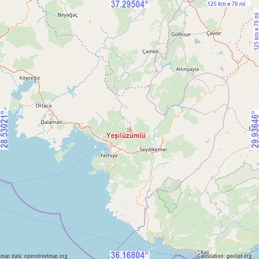
Yeşilüzümlü GPS coordinates[2]
36° 44' 0.996" North, 29° 13' 59.988" East
| Map corner | latitude | longitude |
|---|---|---|
| Upper-left | 37.29504°, | 28.53021° |
| Center: | 36.73361°, | 29.23333° |
| Lower-right: | 36.16804°, | 29.93646° |
| Map W x H: | 125.3×125.3 km | = 77.9×77.9mi |
| max Lat: | 42.02683° ⇑94.5% North |
| Yeşilüzümlü: | 36.73361° |
| min Lat: | ⇓5.5% South 35.9025° |
| min Long | Yeşilüzümlü | max Long |
| 25.90902° | 29.23333° | 44.60099° |
| W 18.5%⇐ | ⇒81.5% E |
Elevation
Elevation of Yeşilüzümlü is 505 m = 1657 ft, and this is 212.4 m = 697 ft below average elevation for this country.
| Max E: |
2682 m = 8799 ft | 60.1% |
| Avg. | 717.4 m = 2354 ft | |
| Yeşilüzümlü | 505 m = 1657 ft | |
Min E: |
0 m = 0 ft | 39.9% |
See also: Turkey elevation on elevation.city.
Geographical zone
Yeşilüzümlü is located in North temperate zone (between Tropic of Cancer and the Arctic Circle). Distance of this Northern Tropic circle is 1478.5 km =918.7 mi to South.| Distance of | km | miles | from Yeşilüzümlü |
|---|---|---|---|
| North Pole | 5922.7 | 3680.2 | to North |
| Arctic Circle | 3316.8 | 2061 | to North |
| Tropic Cancer | 1478.5 | 918.7 | to South |
| Equator | 4084.4 | 2537.9 | to South |


Nearby cities:
15 places around Yeşilüzümlü: (largest is in red/bold)
• Akçay
48 km =29.8 mi,  107°
107°
• Altınyayla
40.4 km =25.1 mi,  43°
43°
• Dalaman
38.5 km =23.9 mi,  275°
275°
• Eşen
31.3 km =19.4 mi,  172°
172°
• Fethiye
14 km =8.7 mi,  222°
222°
• Göcek
25.7 km =16 mi,  274°
274°
• Kargı
14.5 km =9 mi,  255°
255°
• Kemer
14.7 km =9.1 mi,  130°
130°
• Kızılyaka
38.2 km =23.7 mi, 43°
• Ortaca
43.4 km =27 mi,  285°
285°
• Sarigerme
47.2 km =29.3 mi, 267°
• Seki
38.1 km =23.7 mi,  78°
78°
• Yaniklar
16.5 km =10.3 mi, 260°
• Çameli
39.3 km =24.4 mi,  14°
14°
• Ölüdeniz
20.2 km =12.6 mi,  203°
203°
Sources, notices
• [Note1] Compared only with cities in Turkey existing in our database
• [Src1] Map data: © OpenStreetMap contributors (CC-BY-SA)
• [Src2] Other city data from geonames.org with taken over terms of usage.
• [Src3] Geographical zone / Annual Mean Temperature by Robert A. Rohde @ Wikipedia
