Gyuvench geodata
Gyuvench (Hatay) is a seat of a third-order administrative division; located in Turkey in Europe/Istanbul (GMT+3) time zone. In our database, there are 1323 cities with bigger population. Compared to other cities in Turkey, 95.5% of cities are located further ↑North; 54.3% of cities are located further ←West and 59% of cities have higher elevation than Gyuvench. Note1


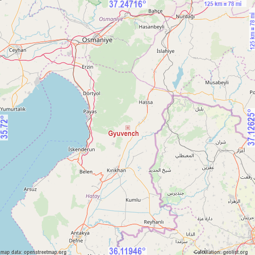
Gyuvench GPS coordinates[2]
36° 41' 7.368" North, 36° 25' 23.232" East
| Map corner | latitude | longitude |
|---|---|---|
| Upper-left | 37.24716°, | 35.72° |
| Center: | 36.68538°, | 36.42312° |
| Lower-right: | 36.11946°, | 37.12625° |
| Map W x H: | 125.4×125.4 km | = 77.9×77.9mi |
| max Lat: | 42.02683° ⇑95.5% North |
| Gyuvench: | 36.68538° |
| min Lat: | ⇓4.5% South 35.9025° |
| min Long | Gyuvench | max Long |
| 25.90902° | 36.42312° | 44.60099° |
| W 54.3%⇐ | ⇒45.7% E |
Elevation
Elevation of Gyuvench is 523 m = 1716 ft, and this is 194.4 m = 638 ft below average elevation for this country.
| Max E: |
2682 m = 8799 ft | 59% |
| Avg. | 717.4 m = 2354 ft | |
| Gyuvench | 523 m = 1716 ft | |
Min E: |
0 m = 0 ft | 41% |
See also: Turkey elevation on elevation.city.
Geographical zone
Gyuvench is located in North temperate zone (between Tropic of Cancer and the Arctic Circle). Distance of this Northern Tropic circle is 1473.1 km =915.3 mi to South.| Distance of | km | miles | from Gyuvench |
|---|---|---|---|
| North Pole | 5928 | 3683.5 | to North |
| Arctic Circle | 3322.1 | 2064.3 | to North |
| Tropic Cancer | 1473.1 | 915.3 | to South |
| Equator | 4079 | 2534.6 | to South |


Nearby cities:
15 places around Gyuvench: (largest is in red/bold)
• Aktepe
5.8 km =3.6 mi,  71°
71°
• Aşağı Karafakılı
15.9 km =9.9 mi,  49°
49°
• Balarmudu
4.7 km =2.9 mi,  196°
196°
• Belen
29.9 km =18.6 mi,  222°
222°
• Demirkonak
14.7 km =9.1 mi,  140°
140°
• Denizciler
19.3 km =12 mi,  255°
255°
• Dörtyol
24.2 km =15 mi,  314°
314°
• Hassa
15.2 km =9.4 mi,  33°
33°
• Konaklı
18.2 km =11.3 mi,  317°
317°
• Kırıkhan
21.5 km =13.4 mi, 195°
• Mahmutlar
35.8 km =22.2 mi, 324°
• Payas
20.2 km =12.6 mi,  292°
292°
• Yalangöz
14.2 km =8.8 mi,  148°
148°
• Çırtıman
28 km =17.4 mi,  230°
230°
• İskenderun
24.8 km =15.4 mi,  243°
243°
Sources, notices
• [Note1] Compared only with cities in Turkey existing in our database
• [Src1] Map data: © OpenStreetMap contributors (CC-BY-SA)
• [Src2] Other city data from geonames.org with taken over terms of usage.
• [Src3] Geographical zone / Annual Mean Temperature by Robert A. Rohde @ Wikipedia
