Dörtyol geodata
Dörtyol (Hatay) is a seat of a second-order administrative division; located in Turkey in Europe/Istanbul (GMT+3) time zone. With population of 56,513 people, there are 154 cities with bigger population in this country. Compared to other cities in Turkey, 92.4% of cities are located further ↑North; 52.7% of cities are located further ←West and 84.1% of cities have higher elevation than Dörtyol. Note1


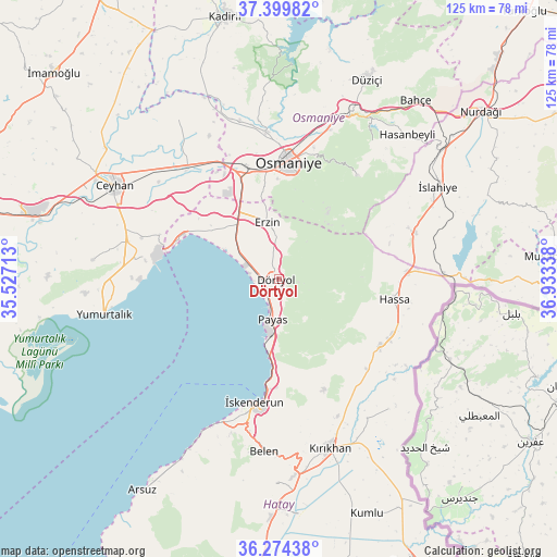
Dörtyol GPS coordinates[2]
36° 50' 21.012" North, 36° 13' 48.9" East
| Map corner | latitude | longitude |
|---|---|---|
| Upper-left | 37.39982°, | 35.52713° |
| Center: | 36.83917°, | 36.23025° |
| Lower-right: | 36.27438°, | 36.93338° |
| Map W x H: | 125.1×125.1 km | = 77.7×77.7mi |
| max Lat: | 42.02683° ⇑92.4% North |
| Dörtyol: | 36.83917° |
| min Lat: | ⇓7.6% South 35.9025° |
| min Long | Dörtyol | max Long |
| 25.90902° | 36.23025° | 44.60099° |
| W 52.7%⇐ | ⇒47.3% E |
Elevation
Elevation of Dörtyol is 79 m = 259 ft, and this is 638.4 m = 2094 ft below average elevation for this country.
| Max E: |
2682 m = 8799 ft | 84.1% |
| Avg. | 717.4 m = 2354 ft | |
| Dörtyol | 79 m = 259 ft | |
Min E: |
0 m = 0 ft | 15.9% |
See also: Dörtyol elevation on elevation.city.
Geographical zone
Dörtyol is located in North temperate zone (between Tropic of Cancer and the Arctic Circle). Distance of this Northern Tropic circle is 1490.2 km =926 mi to South.| Distance of | km | miles | from Dörtyol |
|---|---|---|---|
| North Pole | 5910.9 | 3672.9 | to North |
| Arctic Circle | 3305 | 2053.6 | to North |
| Tropic Cancer | 1490.2 | 926 | to South |
| Equator | 4096.1 | 2545.2 | to South |


Nearby cities:
15 places around Dörtyol: (largest is in red/bold)
• Aktepe
27.4 km =17 mi,  123°
123°
• Aşağı Karafakılı
29.9 km =18.6 mi,  102°
102°
• Balarmudu
26.8 km =16.7 mi,  143°
143°
• Denizciler
22.1 km =13.7 mi,  183°
183°
• Erzin
13 km =8.1 mi,  347°
347°
• Gyuvench
24.2 km =15 mi,  134°
134°
• Hassa
26 km =16.2 mi, 99°
• Konaklı
6.1 km =3.8 mi, 127°
• Mahmutlar
12.7 km =7.9 mi,  344°
344°
• Osmaniye
26.2 km =16.3 mi,  3°
3°
• Payas
9.4 km =5.8 mi,  188°
188°
• Toprakkale
26.6 km =16.5 mi, 343°
• Yarpuz
29.3 km =18.2 mi,  37°
37°
• Çırtıman
35.2 km =21.9 mi, 187°
• İskenderun
28.5 km =17.7 mi, 190°
Sources, notices
• [Note1] Compared only with cities in Turkey existing in our database
• [Src1] Map data: © OpenStreetMap contributors (CC-BY-SA)
• [Src2] Other city data from geonames.org with taken over terms of usage.
• [Src3] Geographical zone / Annual Mean Temperature by Robert A. Rohde @ Wikipedia
