Hassa geodata
Hassa (Hatay) is a seat of a second-order administrative division; located in Turkey in Europe/Istanbul (GMT+3) time zone. With population of 9,719 people, there are 517 cities with bigger population in this country. Compared to other cities in Turkey, 93.3% of cities are located further ↑North; 54.9% of cities are located further ←West and 64.1% of cities have higher elevation than Hassa. Note1


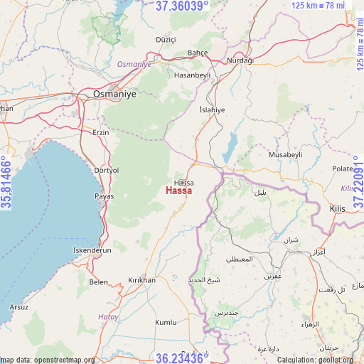
Hassa GPS coordinates[2]
36° 47' 57.984" North, 36° 31' 4.008" East
| Map corner | latitude | longitude |
|---|---|---|
| Upper-left | 37.36039°, | 35.81466° |
| Center: | 36.79944°, | 36.51778° |
| Lower-right: | 36.23436°, | 37.22091° |
| Map W x H: | 125.2×125.2 km | = 77.8×77.8mi |
| max Lat: | 42.02683° ⇑93.3% North |
| Hassa: | 36.79944° |
| min Lat: | ⇓6.7% South 35.9025° |
| min Long | Hassa | max Long |
| 25.90902° | 36.51778° | 44.60099° |
| W 54.9%⇐ | ⇒45.1% E |
Elevation
Elevation of Hassa is 431 m = 1414 ft, and this is 286.4 m = 940 ft below average elevation for this country.
| Max E: |
2682 m = 8799 ft | 64.1% |
| Avg. | 717.4 m = 2354 ft | |
| Hassa | 431 m = 1414 ft | |
Min E: |
0 m = 0 ft | 35.9% |
See also: Turkey elevation on elevation.city.
Geographical zone
Hassa is located in North temperate zone (between Tropic of Cancer and the Arctic Circle). Distance of this Northern Tropic circle is 1485.8 km =923.2 mi to South.| Distance of | km | miles | from Hassa |
|---|---|---|---|
| North Pole | 5915.3 | 3675.6 | to North |
| Arctic Circle | 3309.5 | 2056.4 | to North |
| Tropic Cancer | 1485.8 | 923.2 | to South |
| Equator | 4091.7 | 2542.5 | to South |


Nearby cities:
15 places around Hassa: (largest is in red/bold)
• Aktepe
11.3 km =7 mi,  194°
194°
• Aşağı Karafakılı
4.2 km =2.6 mi,  122°
122°
• Balarmudu
19.8 km =12.3 mi,  209°
209°
• Demirkonak
24.1 km =15 mi,  177°
177°
• Denizciler
32.3 km =20.1 mi,  236°
236°
• Dörtyol
26 km =16.2 mi,  279°
279°
• Erzin
33.2 km =20.6 mi,  301°
301°
• Gyuvench
15.2 km =9.4 mi, 213°
• Konaklı
20.7 km =12.9 mi,  271°
271°
• Mahmutlar
33.4 km =20.8 mi, 299°
• Payas
27.5 km =17.1 mi,  259°
259°
• Yalangöz
24.8 km =15.4 mi, 182°
• Yarpuz
28.7 km =17.8 mi,  344°
344°
• Yedigöz
30 km =18.6 mi,  75°
75°
• İslahiye
27 km =16.8 mi,  21°
21°
Sources, notices
• [Note1] Compared only with cities in Turkey existing in our database
• [Src1] Map data: © OpenStreetMap contributors (CC-BY-SA)
• [Src2] Other city data from geonames.org with taken over terms of usage.
• [Src3] Geographical zone / Annual Mean Temperature by Robert A. Rohde @ Wikipedia
