İskenderun geodata
İskenderun (Hatay) is a seat of a second-order administrative division; located in Turkey in Europe/Istanbul (GMT+3) time zone. With population of 159,965 people, there are 60 cities with bigger population in this country. Compared to other cities in Turkey, 96.4% of cities are located further ↑North; 51.9% of cities are located further ←West and 98.3% of cities have higher elevation than İskenderun. Note1


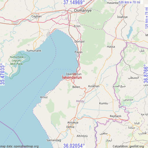
İskenderun GPS coordinates[2]
36° 35' 13.848" North, 36° 10' 24.492" East
| Map corner | latitude | longitude |
|---|---|---|
| Upper-left | 37.14969°, | 35.47035° |
| Center: | 36.58718°, | 36.17347° |
| Lower-right: | 36.02054°, | 36.8766° |
| Map W x H: | 125.5×125.5 km | = 78×78mi |
| max Lat: | 42.02683° ⇑96.4% North |
| İskenderun: | 36.58718° |
| min Lat: | ⇓3.6% South 35.9025° |
| min Long | İskenderun | max Long |
| 25.90902° | 36.17347° | 44.60099° |
| W 51.9%⇐ | ⇒48.1% E |
Elevation
Elevation of İskenderun is 9 m = 30 ft, and this is 708.4 m = 2324 ft below average elevation for this country.
| Max E: |
2682 m = 8799 ft | 98.3% |
| Avg. | 717.4 m = 2354 ft | |
| İskenderun | 9 m = 30 ft | |
Min E: |
0 m = 0 ft | 1.7% |
See also: İskenderun elevation on elevation.city.
Geographical zone
İskenderun is located in North temperate zone (between Tropic of Cancer and the Arctic Circle). Distance of this Northern Tropic circle is 1462.2 km =908.6 mi to South.| Distance of | km | miles | from İskenderun |
|---|---|---|---|
| North Pole | 5938.9 | 3690.3 | to North |
| Arctic Circle | 3333.1 | 2071.1 | to North |
| Tropic Cancer | 1462.2 | 908.6 | to South |
| Equator | 4068.1 | 2527.8 | to South |


Nearby cities:
15 places around İskenderun: (largest is in red/bold)
• Aktepe
30.6 km =19 mi,  65°
65°
• Anayazı
29.6 km =18.4 mi,  177°
177°
• Arsuz
31.9 km =19.8 mi,  232°
232°
• Balarmudu
21.9 km =13.6 mi, 72°
• Belen
11.1 km =6.9 mi,  170°
170°
• Demirkonak
31.6 km =19.6 mi,  90°
90°
• Denizciler
7 km =4.3 mi,  31°
31°
• Dörtyol
28.5 km =17.7 mi,  10°
10°
• Gyuvench
24.8 km =15.4 mi,  63°
63°
• Konaklı
26.3 km =16.3 mi,  22°
22°
• Kırıkhan
19.1 km =11.9 mi,  120°
120°
• Payas
19.1 km =11.9 mi, 10°
• Serinyol
25.4 km =15.8 mi, 171°
• Yalangöz
29.9 km =18.6 mi, 92°
• Çırtıman
6.9 km =4.3 mi, 174°
Sources, notices
• [Note1] Compared only with cities in Turkey existing in our database
• [Src1] Map data: © OpenStreetMap contributors (CC-BY-SA)
• [Src2] Other city data from geonames.org with taken over terms of usage.
• [Src3] Geographical zone / Annual Mean Temperature by Robert A. Rohde @ Wikipedia
